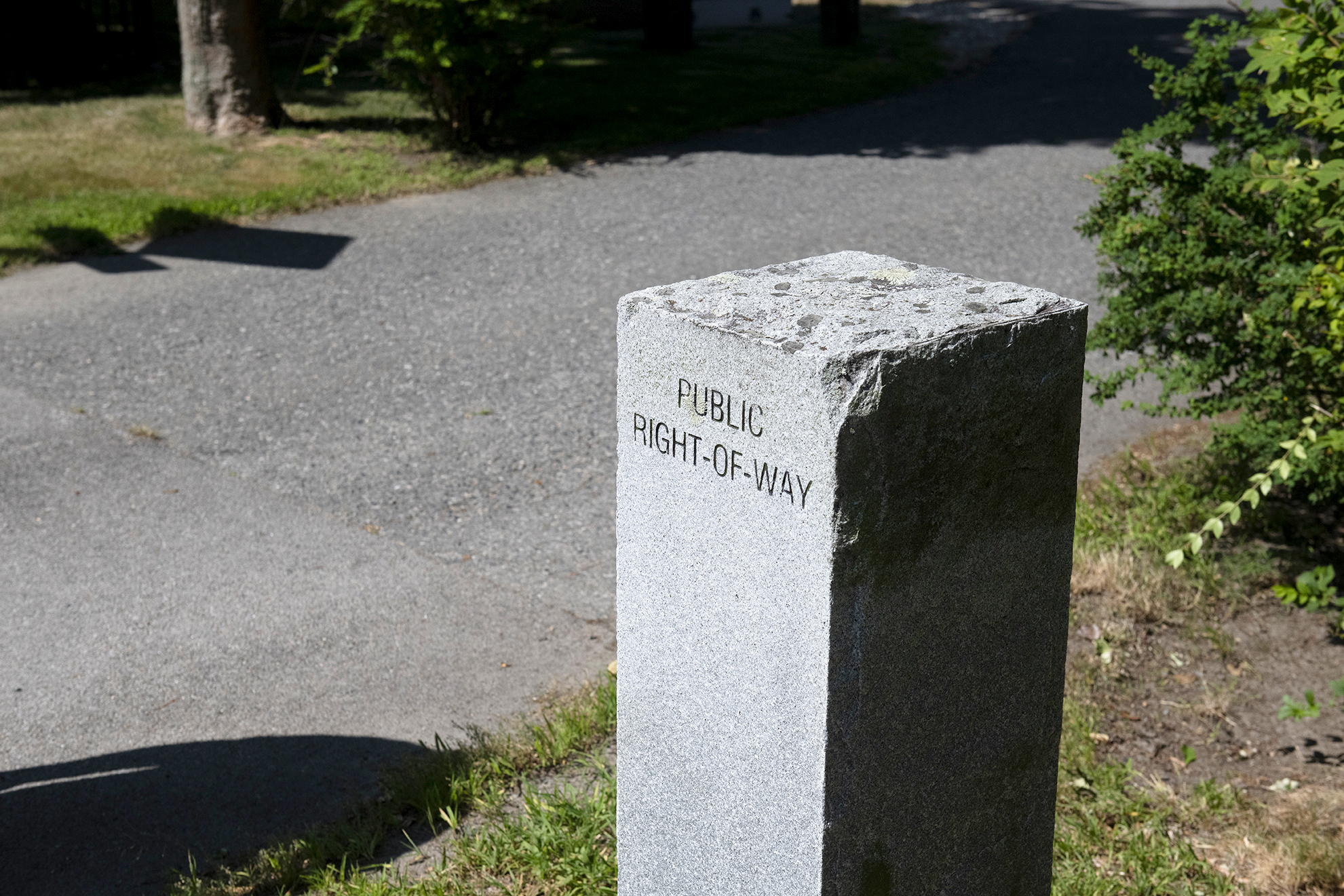
This granite marker denotes the entrance to the Peck Rock Road right-of-way in Bristol.
Shoreline access signs sometimes disappear or are damaged or obscured. The town of Bristol has solved this problem at a number of their rights-of-way (ROWs) by installing granite markers—monoliths that go several feet into the ground and are carved with the words “Public Right-of-Way.”
Kayak racks in Bristol, like this one at Aaron Avenue, are open to nonresidents and may be rented seasonally.
The town harbormaster also keeps an eye on the condition of sites and has a budget for improvements, such as the new metal stairs that were installed at Beach Road a few years ago, or the new kayak racks they are building where you don’t have to be a resident to rent a space. And the town has implemented green infrastructure at storm drains to reduce erosion from rainwater and improve water quality.
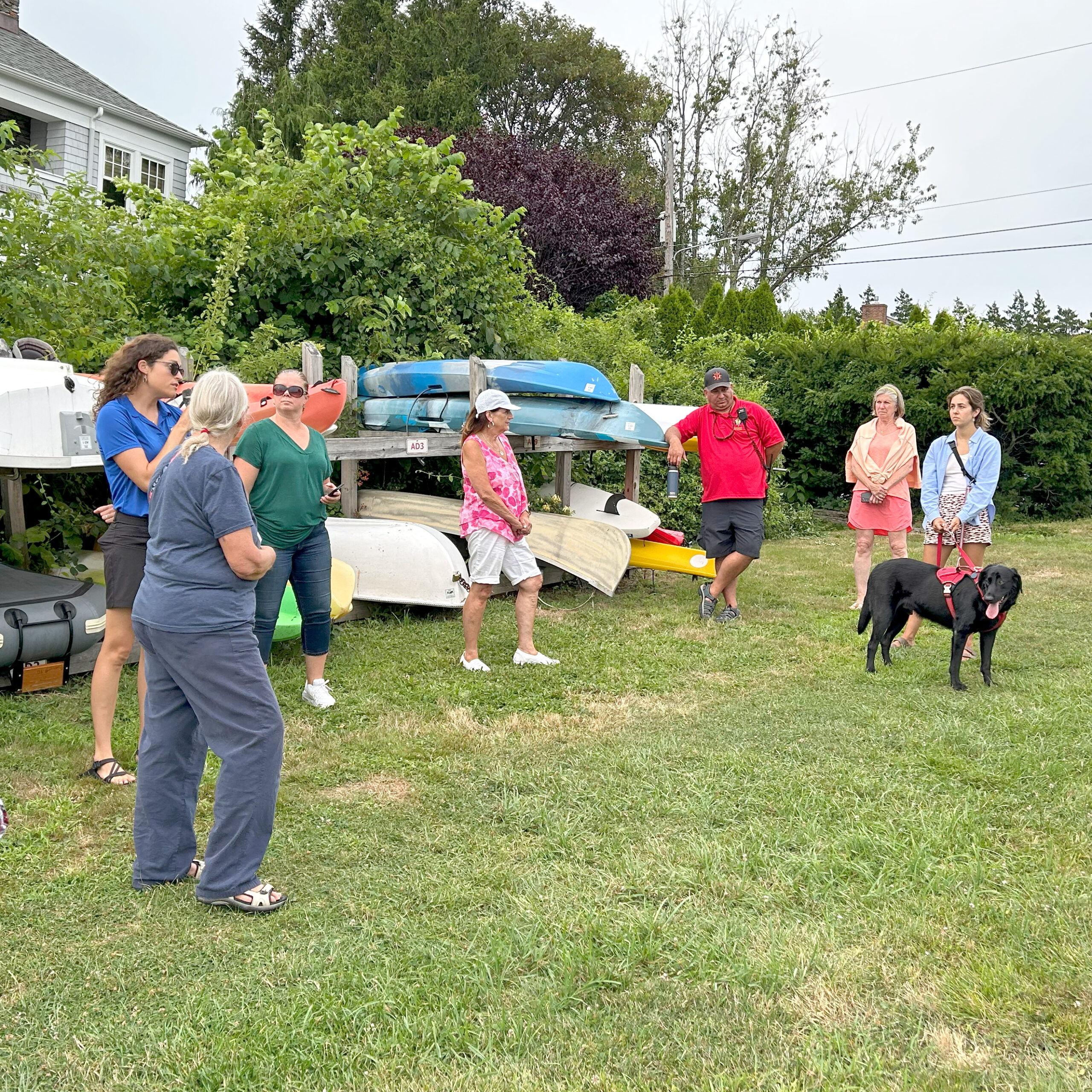
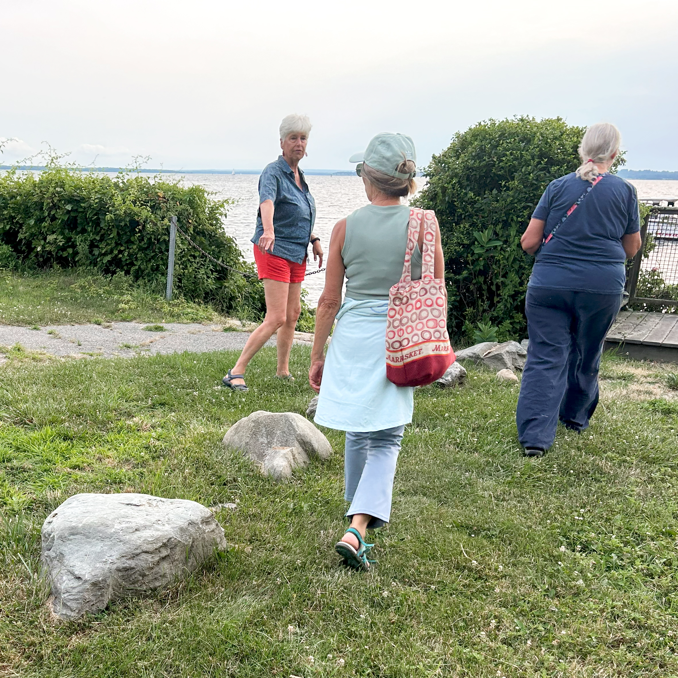
Thirty-five attendees joined staff of the Coastal Resources Management Council, Rhode Island Sea Grant, the University of Rhode Island Coastal Institute, and Bristol Harbormaster Gregg Marsili at a recent walk of shoreline ROWs along the East Bay Bike Path to learn about how sites can be found, how they are designated and maintained, and how to tell how wide they are so you can be sure you’re on the public portion (hint: don’t be fooled by railroad ties or other visual cues that might make a path seem narrower than it is—check the map).
These stones were likely placed as a safety measure, not to mark the boundary of the right-of-way at Gibson Road.
Town leaders and employees are not the only ones taking care of ROWs, however. As the group visited the rocky fishing spot at Peck Road, a neighboring property owner came out and told the group he mows the right-of-way himself. And at the Gibson Road site, where a flower garden encircles the granite marker, retired landscape designer Lelia Stokes Weinstein of the Bristol Highlands Improvement Association described for the group how they maintain the pollinator-friendly garden and focus on planting native species.
Stones at the Gibson Road site might appear to indicate the width of the right-of-way, making it seem as though the (now unusable) boat ramp to the south of the stormwater drainage area is not public. In this case, says Stokes Weinstein, the stones were likely placed there to prevent people from accidentally falling into the drainage area.
Visual cues like this that lead to confusion—the right-of-way that looks like a private driveway, or the signs adjacent to a public site that say “private property”—were one of the main reasons for hosting the walk. CRMC is further trying to make ROW information accessible to the public by adding QR codes to their shoreline access signs that bring people to the CRMC webpage on ROWs and public access. A few more of these stickers were added in Bristol after the walk.
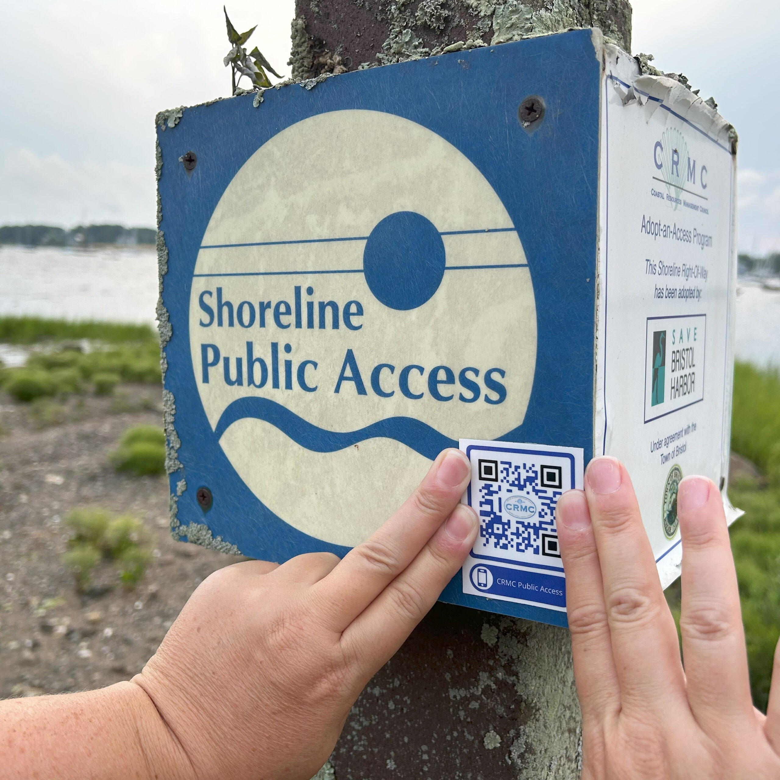
Laura Dwyer of the CRMC affixes a QR code sticker to a shoreline access sign at Oliver Street in Bristol.
For a map of all CRMC-designated ROWs and other information, visit http://www.crmc.ri.gov/publicaccess.html. For a guide with directions to shoreline access sites, both CRMC and state/municipal/private, visit https://www.shoreline-ri.com/. And to learn more about these Bristol ROWs, see this story from 2022.