
This granite marker denotes the public shoreline right-of-way at Gibson Street in Bristol.
Rhode Island has over 200 rights-of-way to the shore, and 34 of them are in Bristol, ranging from narrow paths to spacious beaches.
Under threatening skies, a small but intrepid group of people interested in shoreline access joined Gregg Marsili, Bristol harbormaster; Leah Feldman, policy analyst with the R.I. Coastal Resources Management Council (CRMC); and Janet Freedman and Nathan Vinhateiro of the URI Coastal Institute on a walking tour of a few Bristol public shoreline access sites to learn about some of the work Bristol has done to clearly mark and improve ROWs, how the state designation process works, and some websites the public can use to learn more about CRMC ROWs, find them, and feel confident they are in the right place.
Feldman described how the state designates shoreline ROWs, usually at the request of municipalities and with their assistance or that of interested groups or individuals for research to demonstrate that the area in question is, in fact, public. While CRMC provides ROW signs at the request of the municipalities, these sometimes are damaged or outright removed. Bristol addressed this problem by fundraising for and installing granite markers at all the town’s ROWs. In addition, Marsili said, the town inspects the ROWs semiannually and has set aside funding for ROW improvements, such as installing new metal stairs at the ROW on Beach Road, where the walking tour began.
")
Freedman pointed out that ROWs have different uses based on their physical characteristics — in the case of the Beach Road ROW, there are benches and the stairs, allowing visitors to rest and enjoy the view or venture down to the shore (at low tide; at high tide the bottom of the steps are in the water). Further along the East Bay Bike Path was another ROW adjacent to a private driveway. Some members of the group commented that the site looked like part of the adjacent private property, but the granite marker indicated the location of the ROW. Feldman said that absent these markers, photographs in the websites were also helpful in indicating the entrance to each ROW. This second ROW, Freedman pointed out, could be used as a fishing spot, and on a previous trip, CRMC and Sea Grant staff noted someone fishing from the rocks.

These stairs were installed by the town of Bristol to improve access to Narragansett Bay at Beach Road
At that point, thunder and lightning cut short the tour, but the subsequent sites showed other types of ROWs, one more of a beach (without lifeguards) and the other the end of a storm outflow pipe that had been landscaped to filter stormwater and to which a viewing area with a bench had been added. Many ROWs follow stormwater pipes, some of which are more suitable for public use than others. In this case, the site was adjacent to private property, which was marked as such, so following the granite marker on a perpendicular route to the shore would keep visitors in the public area, with the stormwater outflow area as an additional indicator of the location of the ROW.
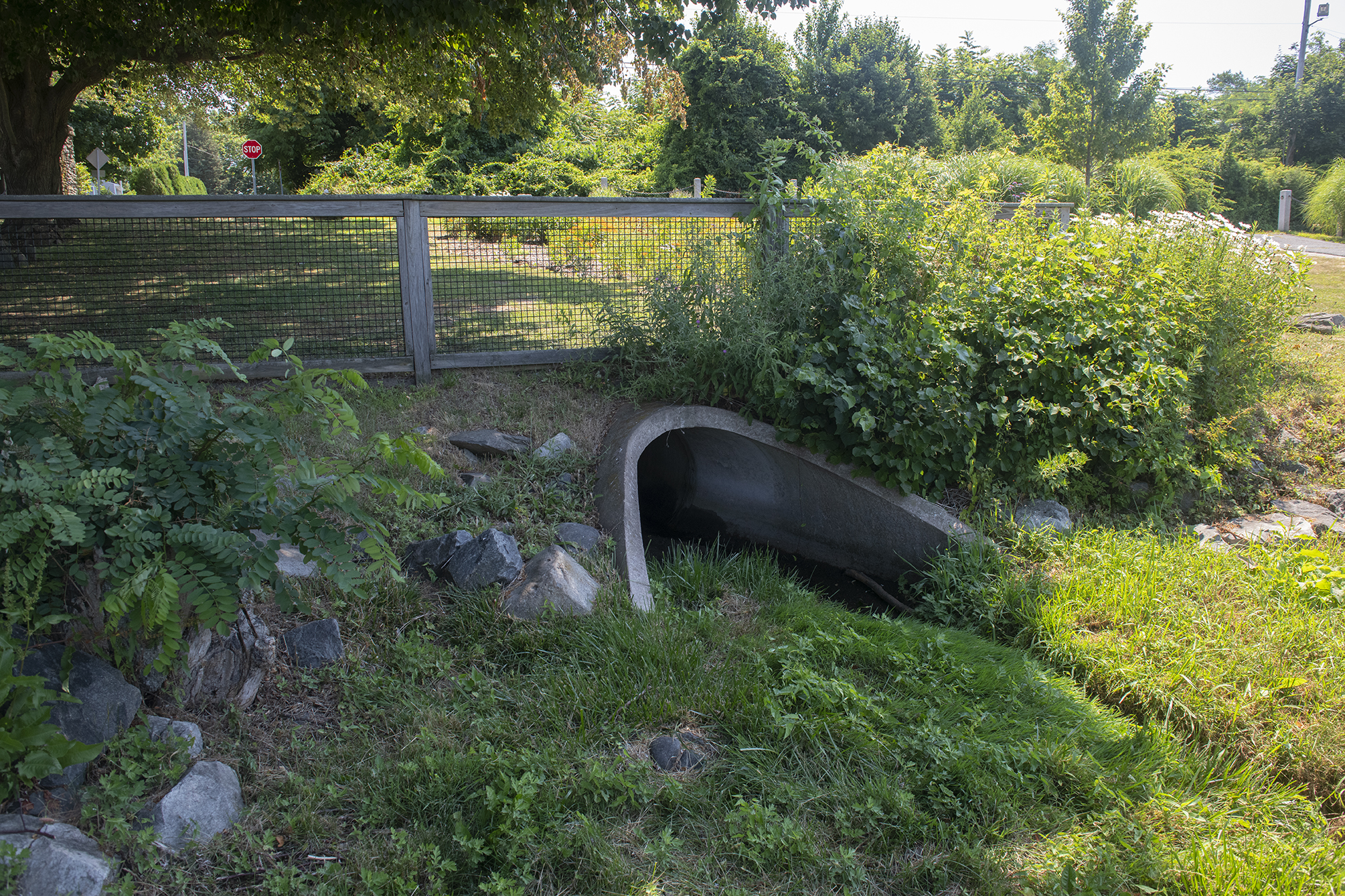
Green infrastructure at this stormwater pipe at Gibson Road is intended to filter stormwater before it reaches the bay.
In addition to its high number of ROWs, their visibility, and their maintenance, Bristol was chosen as the destination for the walking tour because of the availability of on-street parking, which varies from municipality to municipality. In some cases, the lack of public parking can make ROWs reasonably usable only by residents in the immediate vicinity of the ROW. Some towns have tried to address this issue–Narragansett has opened up some on-street parking at some of their ROWs, while Warwick is reportedly assessing whether some of its “no parking” signs on streets near ROWs are appropriate.
The following websites were recommended as guides to shoreline access in Rhode Island. Note: While shoreline-ri.com notes parking availability or lack thereof at some of the ROWs, parking availability can be hard to determine. For instance, though parking may not be allowed immediately adjacent to a ROW, there may be parking on nearby streets, and whether or not that is suitable or close enough is a subjective judgment. Further, parking may be seasonal or time-limited. In some cases, parking has been provided for a very limited number of cars within the right-of-way itself, but those spots may be occupied by vehicles whose drivers are not apparently using the ROW.
ArcGIS Online map of all CRMC-designated rights-of-way to the shore
This application, developed by the URI Coastal Institute, may be used to:
- Navigate to 230 state-designated rights-of-way (ROW) to the shoreline (allow location services on your device to utilize navigation)
- Use the map to select specific locations and view ROW attributes
- Toggle between the default base map, aerial imagery, and a street map, by clicking the eye symbol next to each data layer
- View a sequence of photos of each location
- Download the official designation files for each site
- Search for specific sites or features using the search box
Shoreline-ri.com
This site, which connects to your device’s mapping app to provide routable directions, includes most CRMC ROWs (excluding those where actual access to the shore is difficult or impossible due to obstructions or other site conditions) as well as beaches, parks, historic sites, boat ramps, fishing areas, nature preserves, and more. The site may be searched by municipality or desired activity (e.g., fishing, hiking, swimming, etc.). Information about accessibility, amenities, and tides is included along with identifying photographs for each site.
Learn more about coastal access in the Ocean State at ci.uri.edu/access