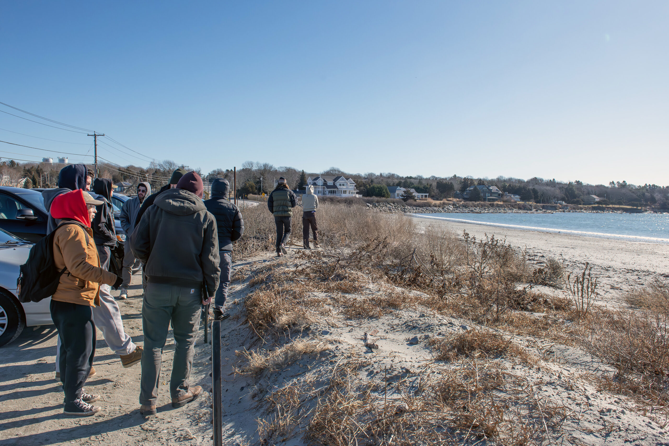
Students in LAR445, the senior capstone, visit Mackerel Cove to get the lay of the land
In July and August, Mackerel Cove beach would be packed with sunbathers, families seeking tranquil waters for their kids to safely swim in, and day campers from a nearby town rec program. The parking area—really the back end of the beach—would rapidly fill with cars, whether from Jamestown residents with recreation passes or tourists paying per day.
This frigid morning in late January, the only visitors are a few town leaders leading a tour for 17 University of Rhode Island Landscape Architecture seniors and their teacher, Hongbing Tang, assistant teaching professor and award-winning landscape architect. They’re here to get a firsthand view of the design challenge they will spend the semester working on, in collaboration with two ocean engineering students who are also working on designs for the area.
They see a flat beach tucked into the curve of Beavertail road, with a small dune system separating the beach from the parking area, which fits about 90 cars. Sheffield Cove, across the street, has a few narrow access paths, which some of the students explore. Others take photographs of the “No Shellfishing” sign on a utility pole. Some walk across a path over the dune, photographing the terrain. Ray DeFalco, parks and recreation director, points out orange cones where the beach “house” with facilities sits each summer. He tells the students it is moved on a custom-built trailer each fall to nearby Fort Getty Park to protect it from increasing winter storms.
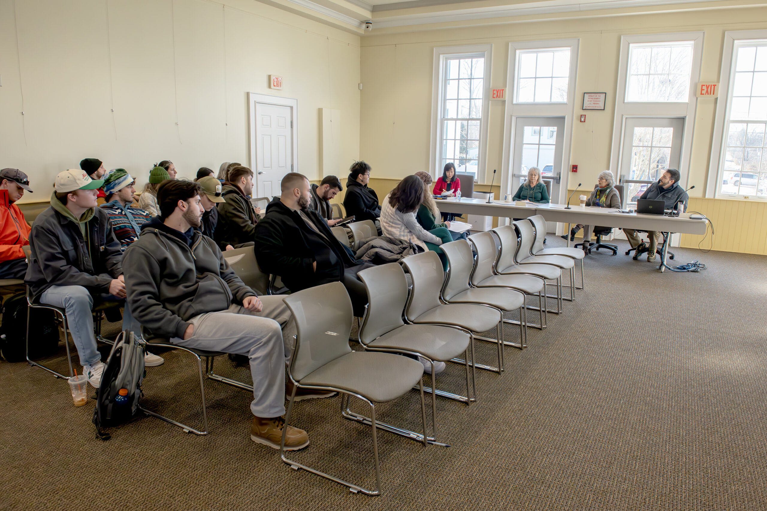
Landscape architecture students learn about Mackerel Cove sea level rise issues in Jamestown Town Hall. At table, from left, are Hongbing Tang, their professor; Lisa Bryer, Jamestown town planner; Mary Meagher, architect and member of the town council; and Ray DeFalco, Jamestown Parks & Recreation director.
Earlier at town council chambers, Lisa Bryer, Jamestown town planner; Mary Meagher, architect and member of the town council; DeFalco; and Anne Kuhn, chair of the town conservation commission, presented to the class the overlapping issues to the two-part charge of protecting Mackerel Cove beach from disappearing to sea level rise for as long as possible, and protecting adjacent Beavertail Road from being inaccessible during storms.
Town leaders explained that Beavertail Road is the only road connecting the residents of the southern peninsula of Jamestown to the rest of the island, and also serves as the access to the popular Beavertail State Park. Where the road runs over the narrow, low-lying strip of land between Mackerel Cove and Sheffield Cove it is at its most vulnerable. Storms that flood that area with water and wash over sand from Mackerel Cove threaten to cut residents off from leaving the area or accessing emergency services.
Raising the road or creating a bridge there would solve the flooding and overwash problem, but would eliminate the beach parking, a source of revenue for the town, and ultimately access to the beach itself. Meanwhile, sand from Mackerel Cove, in past years, has washed into the road, where the municipal public works department has been able to plow it back onto the beach. Three storms in January 2024, however, marked a change.
“The road not only washed over, but the sand, a lot of the sand ended up in the cove behind it … which is Sheffield Cove, is just getting shallower and shallower,” Bryer said. “It’s a protected area. It’s owned by the Audubon Society. And just in terms of recreation, you know, it used to be that you could kayak in there fairly easily, and now it is filled into a point where you really can’t.”
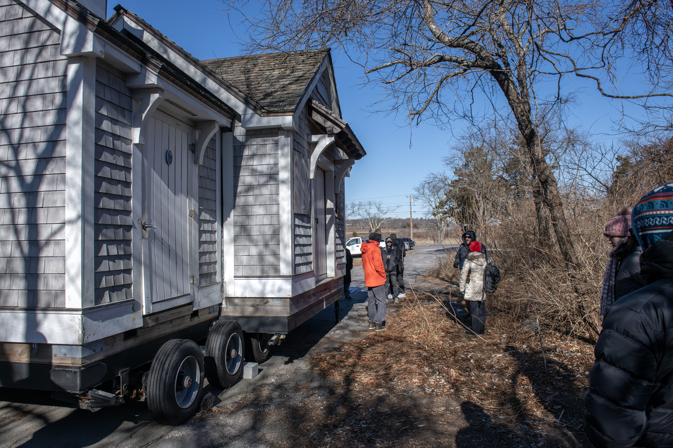
Students inspect the beach facility that the town moves to nearby Fort Getty Park to protect it from storms over the winter.
Regulations around dredging, the private ownership of Sheffield Cove, and its status as a protected area complicate the idea of removing sand from there and putting it back on Mackerel Cove beach. Some students, meanwhile, had floated the idea of installing a culvert, a structure that would channel the water underneath the road. However, once they got on site, “We noticed it’s pretty low to the ground. There’s not much height to it,” student Tim Purcell said. So, he added, “We’re taking a look at the dunes right now. So if there’s a possibility of working with that, making it taller, seeing what we can do, and also what’s going on across the street” at Sheffield Cove.
Dune restoration is something the conservation commission has worked on in the past, said Kuhn, but she and others encouraged the students to be creative.
“I think everything’s on the table, right?” DeFalco said. “And I think it’s what we’re looking for, is many different solutions, and then saying, you know, ‘With this much confidence, we feel like this is the best thing. This is with less confidence.’ Then it’s up to the town officials to really look at all those options and make a decision on what is best for that area.”
The class, along with the two ocean engineering students, is planning to meet with members of the public at the Jamestown Town Hall in late February for their input, and will present final designs publicly at the end of the semester.
LAR445 is supported by Rhode Island Sea Grant as part of its commitment to workforce development in coastal community resilience.