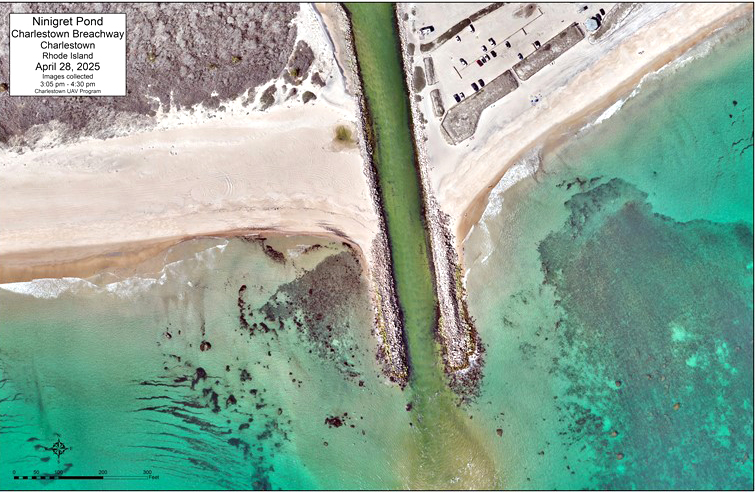
In late 2023 and early 2024, a series of storms caused severe erosion, reducing the elevation of the Charlestown Breachway. As a result, water flowed freely over the west wall and into Ninigret Pond, bringing the sand with it. The beach on the west side of the breachway virtually disappeared.
Emergency repairs were made in October 2024. The temporary repair involved stockpiling rock, leading to sand accretion that restored the beach similar to 2012 pre-Hurricane Sandy levels.
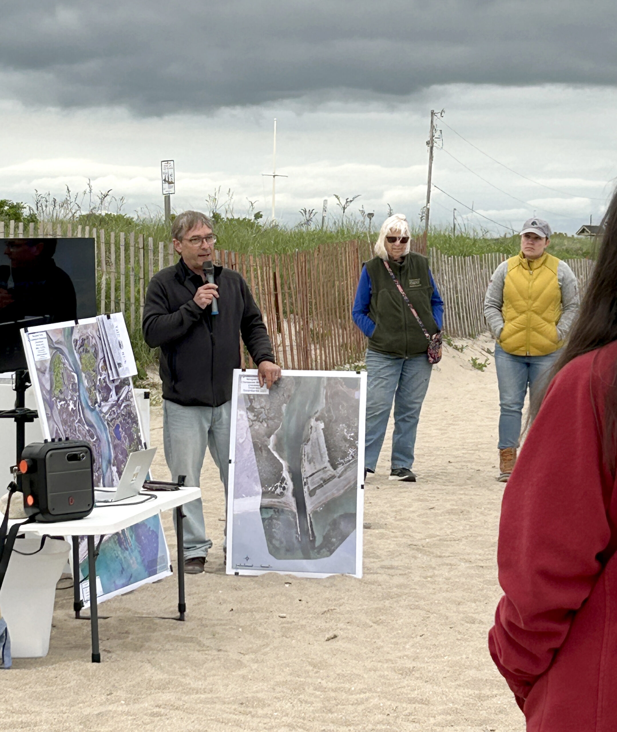
Stephen McCandless, the Geographical Information System coordinator and coastal geologist for the town of Charlestown, explained the success of the emergency repairs to residents who gathered to hear updates on the breachway on May 20, 2025. At this meeting, project leaders also discussed social science findings, the funding and timeline goals, and future plans for the project.

The initial repair to the west wall of the breachway in October 2024 has already brought the beach back to pre-Sandy (2012) levels.

Steve McCandless, Charlestown GIS coordinator and coastal geologist, talks about the success of the breachway restoration project to date, and plans for further improvements to the wall, dredging, and beach nourishment.
Photo by Amanda Gilmore

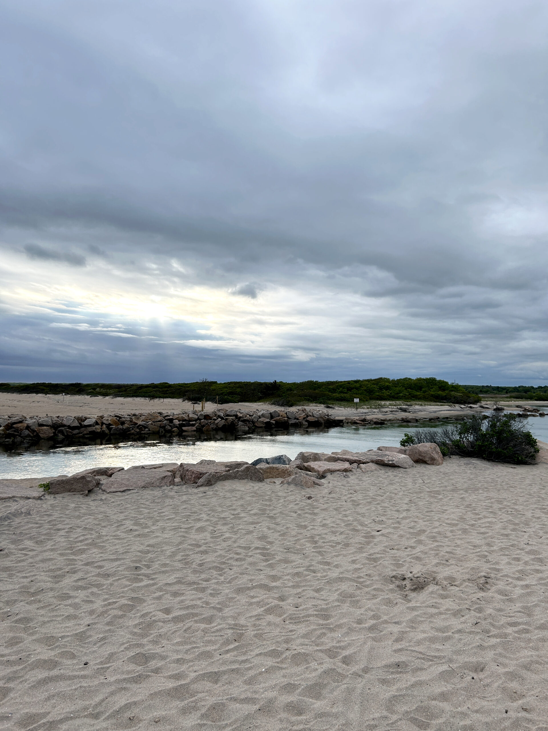
The Charlestown Breachway showing the area that had been repaired.
Photo by Amanda Gilmore
Social scientist and former URI graduate student Jamie-Lynn Ward conducted surveys, interviews and focus groups with URI Assistant Professor Emily Diamond to understand community perspectives, build stakeholder buy-in, and engage the community in resilience efforts.
The researchers found that overall, residents are deeply attached to the town’s coastal areas and want to preserve them, and they feel that the Charlestown Breachway boosts the economy and contributes to the livelihoods of residents, business owners, and tourists. According to Ward, “the people of Charlestown really like to balance the needs of the community with the needs of the environment.”
There was a general consensus among the locals about the transparency of communication from the town and local officials. The residents wanted more communication regarding town planning in addition to information about environmental, economic, and navigability impacts from reliable sources such as scientists, environmental organizations, and government officials.
Emily Hall, Rhode Island Coastal Resources Management Council (CRMC) coastal geologist, addressed what the next steps will be. She described how the project aims to balance resilience with the community’s desire for a stable and familiar landscape. Building on the emergency repair, the next step to build the core of the western jetty is to install armor stones. Armor stones are bigger and more angular, which will create more beach space and regain elevation for high tide. Then, the beaches will be replenished with sand from dredging.
McCandless explained that dredging will take place in Ninigret Pond to dredge the sand that was displaced and use that for beach replenishment as opposed to purchasing sand. The dredge window is open from October to January, but planning to dredge requires the involvement and coordination of many agencies. McCandless announced that permits for dredging are in place and the applications for the final repair plans are submitted. Federal funding was not secured, but McCandless is hopeful to secure state funding after the conclusion of the Rhode Island Legislative session on July 1, 2025. Hall is optimistic to establish firm plans and begin work by this coming winter.
FAQs
Is erosion at the breachway worse than at other areas along Rhode Island’s south shore?
According to McCandless, this area is not very different from the majority of areas along the coast, averaging approximately 2 feet of erosion per year. This rate did increase to about 7 feet per year after Hurricane Sandy due to the destruction of dunes. This project is offsetting that displacement, and he expects the area to return to the previous trend of around 2 feet/year after the breachway is repaired.
What is the timeline for this project?
The first step will be to install the armor rocks and do any rock work necessary before dredging. However, the timeline relies heavily on the dredging window. The dredge season is designed around many environmental and use factors such as winter flounder spawning season. The goal is to take action before the end of the year depending on how funding comes through.
Are there any plans to help the issue of the tidal delta getting too shallow?
No, there are not any plans to help with the ebb tidal delta depth. This is a very complicated situation; jurisdictional issues make it very difficult for the town to work in the area of the ebb tidal delta (sandbar, south of the breachway inlet). The project the town is working on will reduce or eliminate the source of sediment that is causing this sandbar to form. Once the sediment source is managed, natural processes will remove the sandbar.
Can there be a flag system implemented as a warning? Could the harbormaster help with that?
McCandless said it would be a great idea to have some kind of notification of conditions and that it may be possible to get the Harbor Master and Coastal Pond Management Commission involved to support this idea.
What is the dredging plan for the breachway?
The town has obtained all necessary dredging permits. These maintenance dredge permits are good for 10 years, similar to the previously approved 10-year maintenance dredge permits. The permits include three main approved dredge areas, primary sedimentation basin, secondary sedimentation basin, and a relief channel. The primary sedimentation basin is the area between Elbow Beach and the State Campground and back into the pond. The primary basin is approximately 1,700 feet long by 200 feet wide and approved to be dredged to 8 feet mean lower low water (MLLW) plus or minus 1 foot.
The secondary sedimentation basin is further north into the pond located along the north sandbar in the pond. This basin is approximately 900 feet long with an average width of 200 feet, approved to be dredged to 8 feet MLLW plus or minus 1 foot.
The relief channel connects the primary basin through the secondary basin and continues north east to an area just south of Tockwotten Cove, 3,000 feet long by 125 feet wide and approved to be dredged to 4 feet MLLW plus or minus 1 foot.
When will the rock work start? Are you going to use the same system for your supply chain in terms of storing it at Blue Shutters and running it down and using East Beach Rd?
It is up to the contractors to decide the most productive system. It is most economical to start at Blue Shutters and truck materials, as it minimizes the cost of mobilization. It will be easier this year to move materials because the beach has already been partially restored naturally over the winter.
Have federal changes affected the project?
Initial plans were submitted last year, but there were federal funding cuts this year. However, the town has been approached by their federal representatives and asked to resubmit. McCandless rewrote the application and asked for a total of $6.5 million. He is currently waiting for the final determination.
Are there rocks from the seawall in the breachway that could pose a hazard to boaters?
Any rocks pushed into the water by Hurricane Sandy have been removed. Boaters would have to be very close to the wall to be in danger of hitting any underwater rocks.
More Information
For more information, contact Casey Tremper, coastal specialist with the University of Rhode Island Coastal Resources Center and Rhode Island Sea Grant, at casey_tremper@uri.edu or visit Charlestown’s page with breachway updates.
—By Sophia Milman, Rhode Island Sea Grant Communications Intern
