As sea levels rise and coastal erosion accelerates, Rhode Island’s shorelines are literally on the move. The high tide line—the traditional marker of public coastal access—is shifting inland in many places. This movement raises new questions about where the public can legally walk, fish, and recreate, especially as formerly dry land becomes an intertidal zone. And it challenges local governments to navigate the legal, physical, and social complexities of adapting shoreline access policies to a changing coast.

Group of people walking along East Matunuck Beach during a shoreline tour exploring coastal dynamics and Rhode Island’s shoreline access law. Photo courtesy of Save the Bay.
A new report—Sustained Shoreline Access and Rising Seas: Rhode Island’s Coast in a Changing Climate—by Rhode Island Sea Grant Law Fellow Dietrich Vogel examines how climate-driven coastal change is putting long-standing shoreline access rights at risk. It outlines a range of legal tools communities can adapt to their own geography, development pressures, and future flood risks.
This work supports a broader Sea Grant–funded project led by the University of Rhode Island’s Coastal Institute, which is studying how sea level rise and erosion intersect with public access—particularly in flood-prone areas like Bristol County.

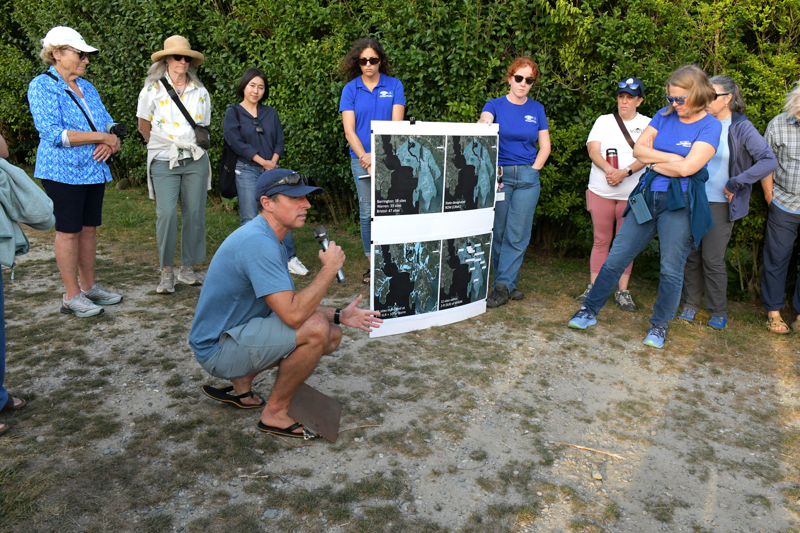
Nathan Vinhateiro, URI Coastal Institute Science Director, shows aerial views of where Barrington shoreline access sites will be impacted by sea level rise.
“We wanted to identify examples in the U.S where state or local governments have enacted policies that accommodate coastal access along developed shorelines and provide options for communities, like those in Bristol County, that are vulnerable to flooding, erosion and sea level rise.”
Vogel highlights several examples of communities, both in Rhode Island and other states, utilizing regulatory tools such as Special Area Management Plans (SAMPs) to safeguard public shoreline access. In North Carolina, for instance, coastal setback laws are used to prevent permanent structures from encroaching on public beach areas, ensuring the protection of public access rights.
These setback regulations are based on shoreline erosion rates and the size of the proposed development to maintain lateral public access. The larger the structure, and the more rapid the erosion, the greater the required setback distance, to reduce the risk of damage and to preserve public access along the shore.
The report also references Texas’ Open Beaches Act, which sought to establish rolling easements, allowing public access along the coastline as it shifts due to erosion. However, the Texas Supreme Court ruled that the Act did not create a “rolling easement” for dry beach areas, underscoring the legal challenges faced by such laws.
Shoreline Change is Not Uniform
According to the EPA’s 2024 report, Shoreline Change as an Indicator of Climate Change, coastal erosion is highly variable—even within a single state. Factors like wave exposure, land cover, and the presence of manmade infrastructure all affect how fast and in which direction the shoreline moves.
This underscores a key takeaway from the Sea Grant report: There is no one-size-fits-all solution. Instead, Rhode Island’s municipalities must craft access strategies that reflect local conditions—and that can evolve as coastlines continue to change.
Legal Tools for Access
The report outlines several land-use strategies communities can use to preserve both lateral access (walking along the shore) and perpendicular access (getting to the shore from inland areas). These include more commonly used tools like setbacks, easements, and property buyouts.

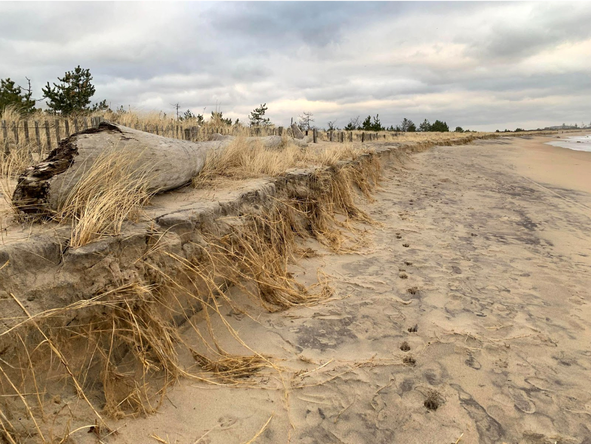
Beach erosion, Weekapaug Fire District Beach, Westerly, RI: Sea level rise, increasing storm events, and large storm surges are wearing away our coastal beaches and other shorelines. Photo by Jim Turek
Setbacks require buildings to be placed a certain distance from the shoreline, and are primarily aimed at reducing erosion and flood risks—but they also help preserve walking access along the coast. In Rhode Island, the Coastal Resources Management Council (CRMC) sets minimum setback distances and requires public access plans for larger developments. Some towns, like Bristol, have added zoning rules that ban construction on dunes or seaward of the high tide line. Still, the report notes that more restrictive setback policies could face legal challenges under the Fifth Amendment’s takings clause.
Easements
Conservation Easements
Allow landowners to limit development while retaining ownership—sometimes with tax incentives.
Rights-of-way (ROWs)
Enable perpendicular access to the shore and, once designated by CRMC, cannot be revoked without consent.
Rolling Easements
A forward-looking option that let public access move inland as the shoreline does. While not yet tested in Rhode Island courts, they echo the logic of the state’s new 10-foot law and may become increasingly relevant.
Property buyouts offer another path to preserving shoreline access by compensating owners of at-risk properties. These voluntary programs can turn vulnerable land into public open space. The report points to New York’s post-Hurricane Sandy buyout program as a potential model for Rhode Island.
Additionally, the report highlights Special Area Management Plans (SAMPs) as crucial tools for maintaining public access. SAMPs use ecosystem-based planning to balance development with environmental protection, requiring developers to provide or replace public access if it’s impacted.
The Takeaway?
There’s no one-size-fits-all solution. Municipalities must weigh a mix of tools—setbacks, easements, buyouts, and zoning—to protect shoreline access in ways that reflect their unique issues.
The Rhode Island Sea Grant Legal Program, based at the Roger Williams University School of Law, provides legal research, analysis, and outreach on coastal and marine law and policy issues.
As part of the Rhode Island Sea Grant College Program, the Legal Program supports coastal communities, policymakers, businesses, and stakeholders by offering expert guidance on topics such as public shoreline access, fisheries management, aquaculture regulation, climate resilience, and environmental law. Through its legal research, publications, and engagement efforts, the program helps address complex legal challenges and informs decision-making to promote sustainable coastal and marine resource management in Rhode Island and beyond. To Learn More >>
– By Meredith Haas, Research Communications and Digital Media Manager
