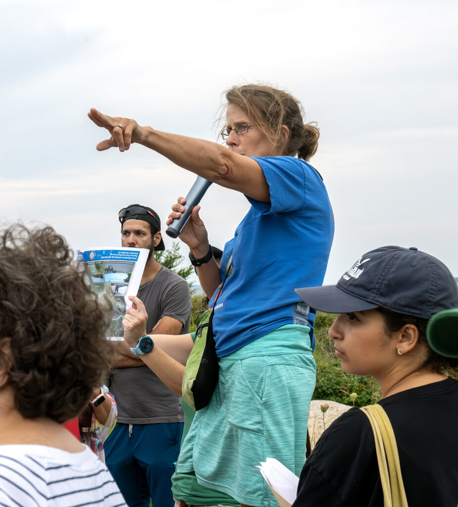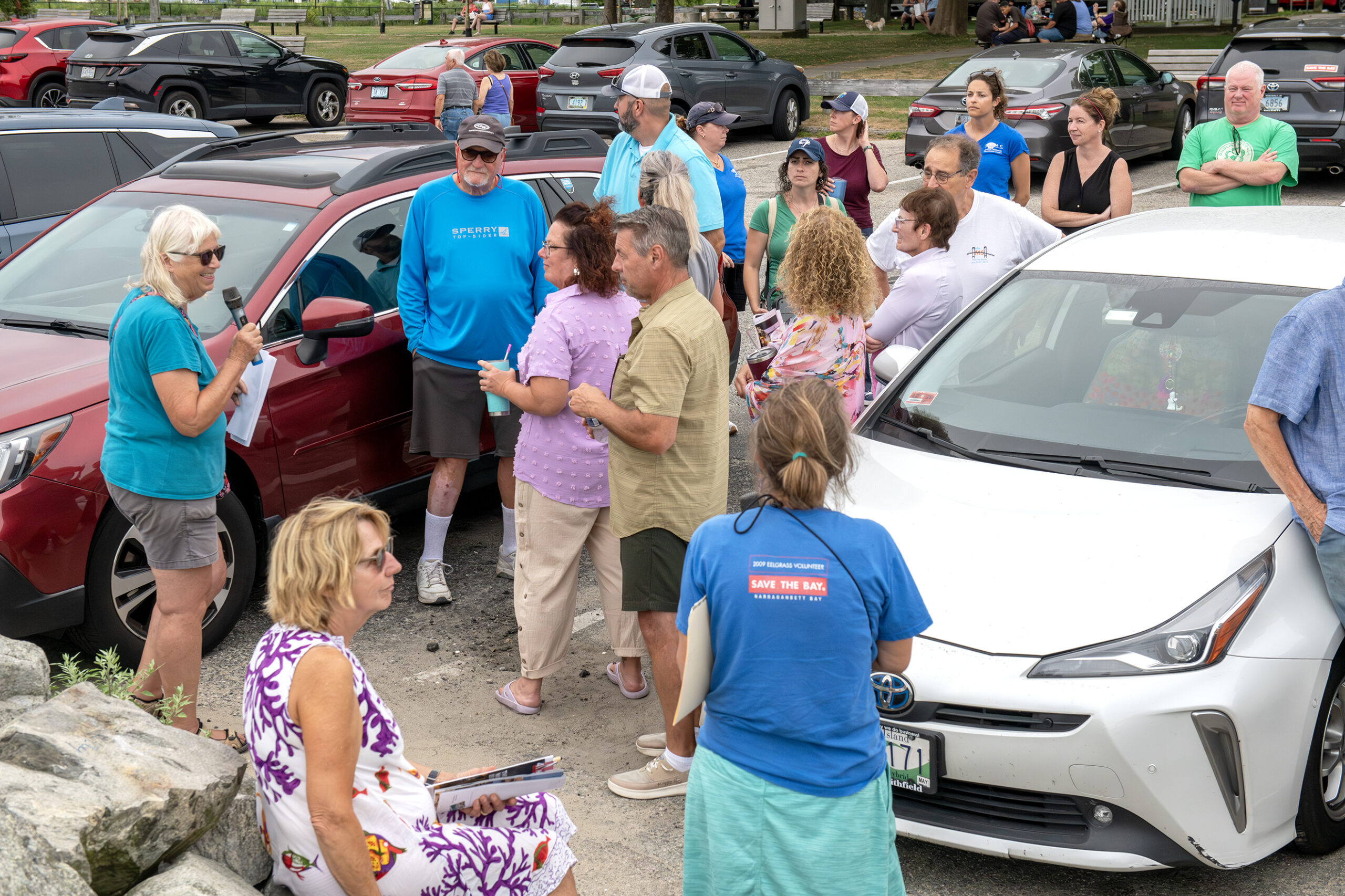
Coastal geologist Janet Freedman talks about how high tides push seawater back up through the storm drain at the Oakland Beach seawall, flooding the parking lot. Wenley Ferguson is in the foreground in the Save The Bay t-shirt. Photo by Amanda Gilmore
Warwick’s Oakland Beach is bustling in the summer, with visitors enjoying the shore, car shows, concerts, and restaurants. But frequent beach closures and king-tide flooding of neighborhood streets hindered both quality of life and the local economy. Over a decade ago, the city led plans to improve stormwater management and reduce flooding, and today, with state and federal funding, major investments have transformed the area.
Rhode Island Sea Grant, the University of Rhode Island Coastal Institute, the Rhode Island Coastal Resources Management Council, and Save The Bay recently hosted a walking tour of Oakland Beach to look at the changes and see where future efforts are planned.
Storm Drains Flow Both Ways
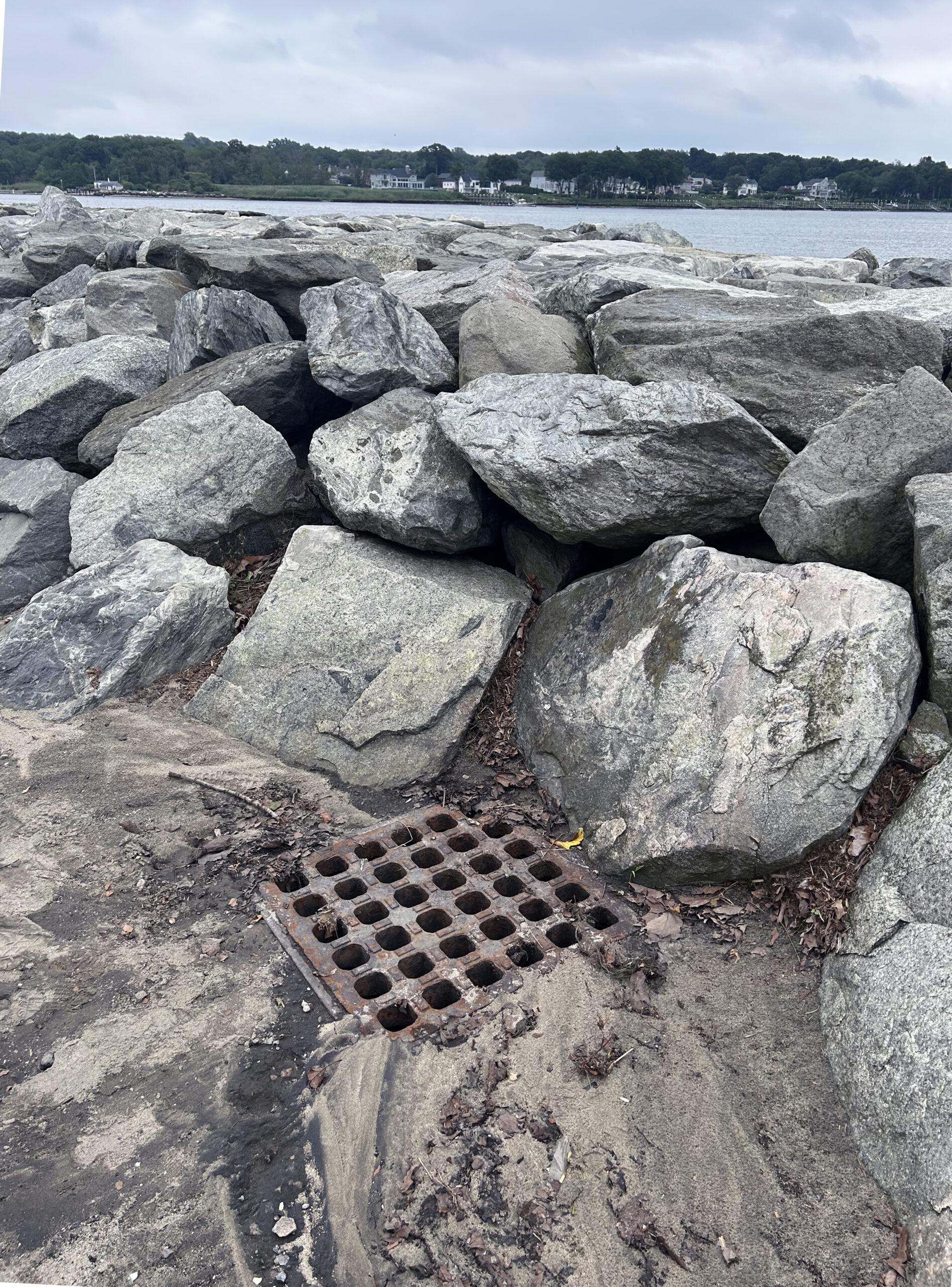
A storm drain at Oakland Beach surrounded by sand shows that seawater flows back up through the drain during certain high tides. Photo by Monica Allard Cox
The storm drain behind the seawall was surrounded by beach sand.
“You notice it’s wet? That’s actually sea water. When the tides are high, the sea water backs up through these and floods the parking lot,” said Janet Freedman, senior fellow of the URI Coastal Institute and retired CRMC coastal geologist.
Wenley Ferguson, habitat restoration director for Save The Bay, concurred. “We know it’s salt water because this plant right down here, that’s called the seaside goldenrod. It is a salt marsh plant.”
Keeping Trash off the Beach and Out of the Water
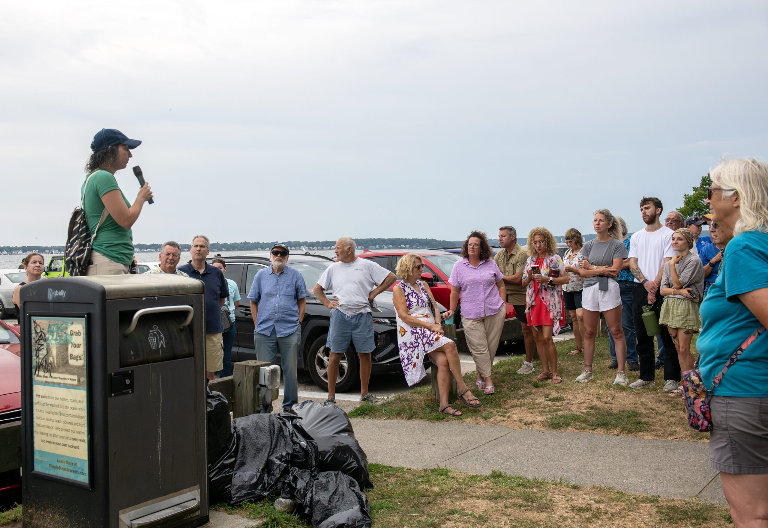
Casey Tremper talks about how MyCoast is helping prioritize flooding sites for remediation. The trash compactor in the foreground is part of an early effort to prevent trash from getting into the bay. The trash bags are there from a Save The Bay cleanup of the site earlier in the day. Photo by Amanda Gilmore
The walking tour of Oakland Beach moved on from there, after noting that one of the city’s early efforts to improve water quality from runoff was right there in the parking lot—a “Bigbelly” trash compactor that replaced open trash cans that allowed waste to blow away into the water—and allowed seagulls to rifle through the contents, increasing the problem of bird droppings.
MyCoast to Aid RIDOT for Street Repairs
Casey Tremper, coastal project manager for the URI Coastal Resources Center and Rhode Island Sea Grant, talked about MyCoast, the app that allows resources managers and others to track where flooding is a problem around the state thanks to volunteer-uploaded photos taken during storms and king tides.
“We are interested in learning from where you guys are seeing the flooding,” Tremper told the participants. She added that the Rhode Island Department of Transportation plans to “start using this data to inform what streets they’re looking at to repair, so that it’s actually coming from people’s lived experiences, rather than just the squeaky wheel that knows who to call.”
Filtering Stormwater to Improve Water Quality, Reduce Beach Closures
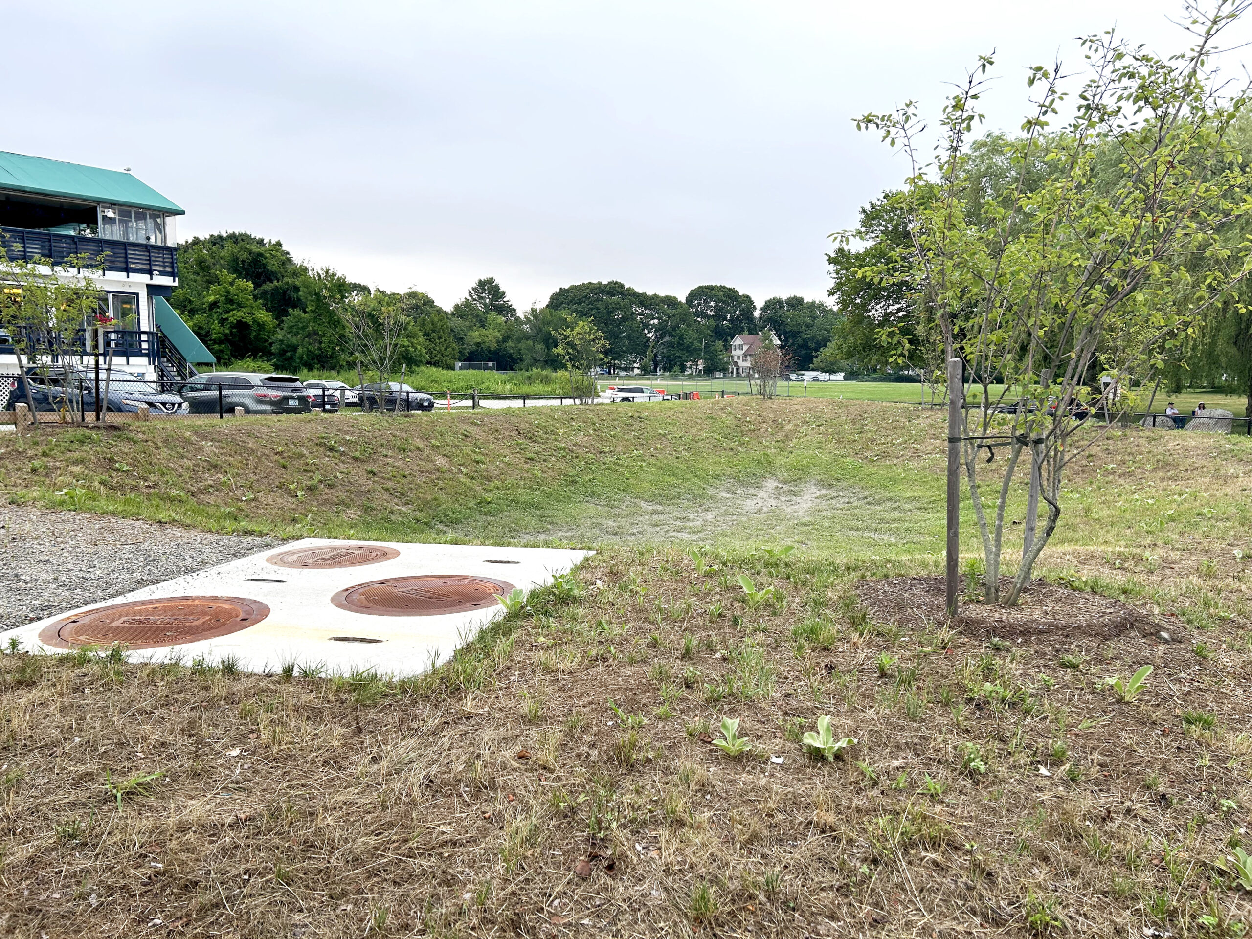
Oakland Beach stormwater infiltration area. Photo by Monica Allard Cox
A decade ago, a team of partners including the URI Coastal Resources Center, Rhode Island Sea Grant, Save The Bay and the city of Warwick, developed a project for Oakland Beach Avenue to filter stormwater runoff, which at the time “just went straight into the parking lot, down into a catch basin, and out into the bay untreated,” Ferguson said.
The city in recent years obtained funding to build the proposed stormwater infiltration area, so now “all of that runoff, instead of flowing untreated directly into Narragansett Bay, sinks into the ground, and the pollutants are removed through that process,” Ferguson said. City staff periodically remove any trash that gets washed into the infiltration area.
Native Plants, Dune Serve as Buffer Between Managed Landscape and Beach
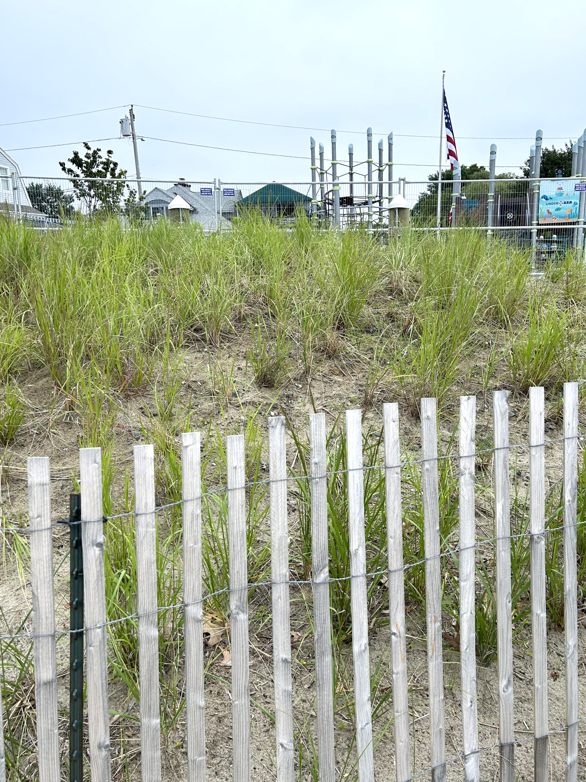
Volunteers planted switchgrass and seaside goldenrod between the beach and the new playground at Oakland Beach. Photo by Monica Allard Cox
The Warwick Planning Department reached out to Ferguson about creating a more natural transition area between the playground and the beach and adding more native plants.
The city worked with Save The Bay on a planting plan and brought in more sand, and they, along with dozens of community volunteers, planted a combination of seaside goldenrod, which is a pollinator habitat for migrating monarchs, and switchgrass.
Tall and wispy, switchgrass is “a very drought-tolerant native grass, and it has really deep roots, which are great for erosion control,” Ferguson said.
“This is supposed to be a natural transition of native coastal plants between the managed landscape up here and the beach below, and it’s more resilient to wave energy and surge, when a large storm event does occur,” she added.
Road-end Retrofit Increases Public Shoreline Access, Reduces Flooding
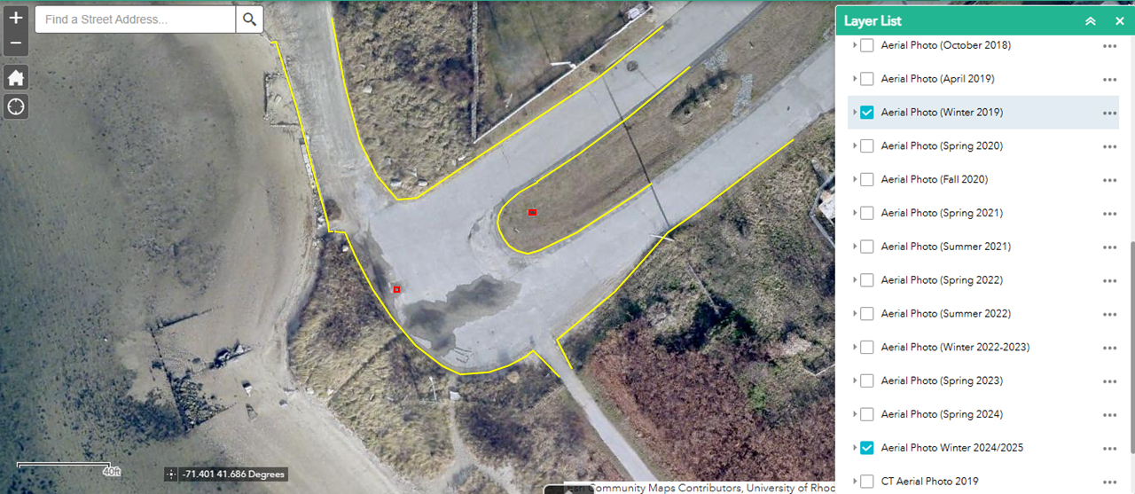
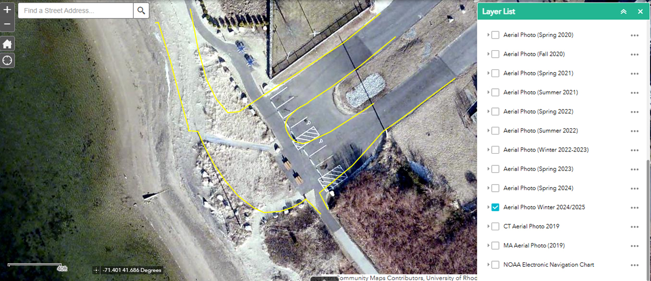
Top 2019 aerial shows how Strand Avenue, adjacent to Sunset Beach in the Oakland Beach neighborhood, looked before it was moved back from the shore. Bottom aerial shows Strand Avenue as it looks today. The yellow lines indicate where the pavement had been.
Strand Avenue is shaped like a sideways letter U. The bottom of the “U” is adjacent to Sunset Beach, and was prone to flooding during king tides.
The city worked with Save The Bay, Ferguson said, and had community meetings with the Oakland Beach Neighborhood Association on a remediation plan that widened the natural area by pulling back pavement and adding plantings, improving stormwater management, and enhancing public access through additional parking spaces, a walking path, accessible picnic tables, and mobility mats for wheelchair access to the beach.
Ferguson emphasized that shoreline access was a key component of the project.
“If you pull pavement away from the water’s edge, that space can now become usable space for people and wildlife.”
She added that a Phase 2 of the project could include more invasive removal on adjacent city- owned land and because the paved path is already seeing some flooding, addressing additional resilience measures as well.
This walk was one of a series by Rhode Island Sea Grant, the URI Coastal Institute, and the CRMC highlighting coastal resilience and shoreline access in Rhode Island.
—by Monica Allard Cox
Wenley Ferguson points to where flooding had been a problem on Strand Avenue in the Oakland Beach neighborhood of Warwick. Photo by Monica Allard Cox
More Information:
- MyCoast seeks volunteers to capture effects of high tides and storm events across Rhode Island.
- View StormTools to illustrate storm inundations under different conditions across Rhode Island.
- Watch a short video showing Save The Bay’s Wenley Ferguson and volunteers planting beach grass at Oakland Beach.
- See the green infrastructure plans for Oakland Beach developed through the Green and Resilient Infrastructure Planning (GRIP) project
- In this short video, see how The Nature Conservancy helped Warwick with nature-based solutions at Oakland Beach

