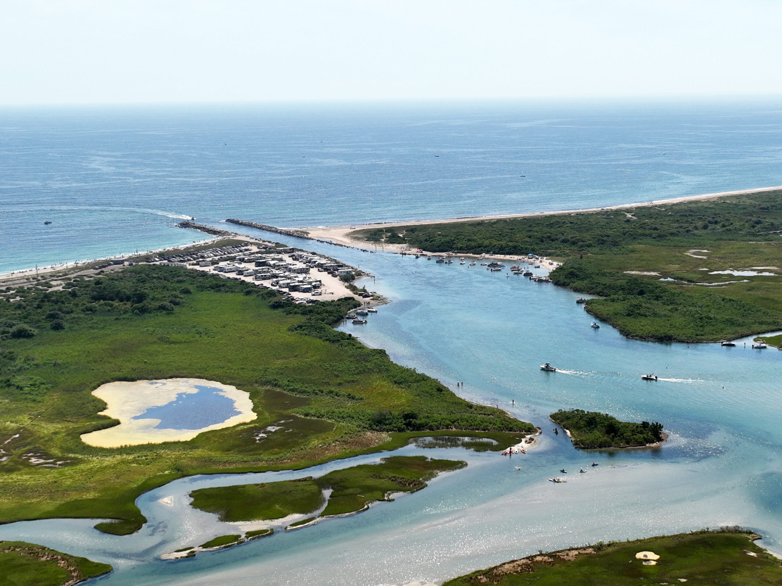
Aerial view of the Charlestown Breachway. Photo courtesy of the town of Charlestown.
Following the damage to the Charlestown Breachway in late 2023 and early 2024 and the emergency repairs done, Charlestown is preparing for the permanent restoration.
The town of Charlestown has collaborated with the Coastal Resources Management Council (CRMC), the Rhode Island Department of Environmental Management (DEM), the Rhode Island Infrastructure Bank, the Salt Ponds Coalition, and Rhode Island state legislators to secure funding for construction.
Stephen McCandless, the Geographical Information System coordinator and coastal geologist for the town of Charlestown, said at a public meeting on August 7 that the majority of funding has come through.
- $2 million is designated for dredging from the state.
- DEM and CRMC secured $5 million under the South Coast Habitat Restoration fund.
- $1.4 million is coming from the town of Charlestown Beach and Pond Preservation fund.
One of the final steps before construction is to finalize all permits and design plans.

Charlestown has installed a CoastSnap station at the breachway, with another soon to follow. Visitors can help keep an eye on how the area is holding up by taking photos and uploading them to an app. CoastSnap photo by K. Kreutler.
McCandless worked with Emily Hall, coastal geologist for CRMC, to create plans for a permanent repair of the breachway and restoration of the dunes.
Hall explained the structural plans for the breachway will include a core of smaller rocks, then large armor stones, and artificial dunes as a “line of defense” in front where the breachway previously broke. However, the dunes will take approximately 10 years to fully recover to the condition prior to the storms of 2023 and 2024, and there will be efforts to plant vegetation and bring extra sand to accelerate the process. The goal is “to do it once, and … to do it really well,” said Hall.
The Army Corps of Engineers permitting is complete, and McCandless and Hall are hopeful to begin construction on November 1—after the campground at the breachway run by DEM closes for the season. The project is ultimately slated to be completed by January 2027. More detailed information will be forthcoming soon.

Casey Tremper speaks at a breachway event last year.
Additionally, Casey Tremper, coastal project manager for the URI Coastal Resources Center and Rhode Island Sea Grant, highlighted a CoastSnap station that will be installed on the western side of the breachway, in addition to the existing location on the east side. CoastSnap allows visitors to snap a picture of the beach from a phone mount and to upload it to help scientists understand changes over time.
Just two weeks after the meeting, the breachway was hit with storm surge from Hurricane Erin. McCandless reported that the emergency repair of the breachway held up well.
While some high waves did break through the natural west side dunes, the stonework of the west seawall and the majority of the artificial dune created during the emergency repair remained in place. The effects of the storm surge would have been much worse had the emergency repair not been done, he added. Post storm, the beach has started to recover.
Approximately 70 community members attended the August 7 meeting at the Kettle Pond Visitor Center to learn about the status of this project.
The meeting was organized by the town of Charlestown with assistance from Rhode Island Sea Grant, the Coastal Resources Management Council, the URI Coastal Resources Center, and the Salt Ponds Coalition.
—by Sophia Milman, Rhode Island Sea Grant Communications Intern
More Information:
-
- Town of Charlestown Breachway Restructuring Development
- CoastSnap
- Charlestown Harbormaster Website (includes Breachway Channel Map)