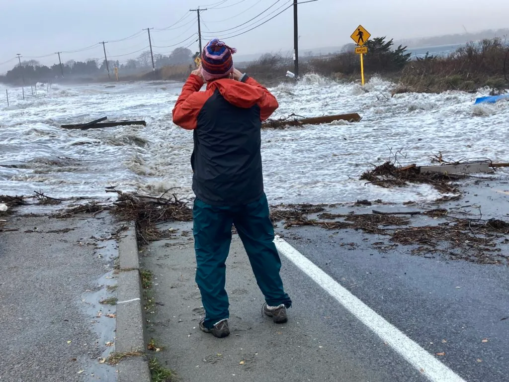
Rhode Island’s nearly 400 miles of coastline face rising seas, stronger storms, and more frequent flooding events. Communities from Westerly to Warren are feeling the impacts, and preparing for what’s ahead requires the best information and tools available.
For more than a decade, Rhode Island Sea Grant has helped advance and apply three critical coastal resilience resources: RI-CHAMP, STORMTOOLS, and MyCoast. Developed with the University of Rhode Island’s Coastal Resources Center, Graduate School of Oceanography, Environmental Data Center, and the Departments of Marine Affairs and Ocean Engineering—in close partnership with agencies such as RIDEM, DOH, RIEMA, CRMC, Navy Station Newport, and local emergency management offices—these tools help emergency managers, planners, and residents anticipate and prepare for hazards.
“These tools are integral to our hazard mitigation strategy and coastal resilience planning,” said Richard Rainer, Town Administrator for Portsmouth, in a letter to the Senate Finance Committee supporting continued funding. “We’ve used them extensively in developing Rhode Island’s first Regional Hazard Mitigation Plan, in collaboration with Newport, Middletown, and Naval Station Newport.”
After a hearing this spring, Rhode Island legislators approved $200,000 in state funding to sustain these programs—recognizing their value not just as technical products, but as decision-making lifelines for the state’s communities.
In a case study for the town of Westerly, researchers in Westerly identified more than 100 “consequence thresholds” resulting from impacts to 11 critical infrastructure facilities in the floodplain. (Source. RICHAMP.ORG)
RI-CHAMP: Predicting Storm Impacts for Emergency Management
When a major storm threatens Rhode Island, emergency managers need to know what’s at risk—fast. Rhode Island’s Coastal Hazards, Analysis, and Prediction system (RI-CHAMP), developed through the U.S. Department of Homeland Security’s Coastal Resilience Center of Excellence, delivers real-time modeling to forecast potential damage from hurricanes and other extreme weather events.
“This is at the leading edge of emergency management forecasting technology for coastal storms,” said Dr. Austin Becker, in state testimony this spring. “It provides a high-resolution forecast for flood and wind in advance of a hurricane’s landfall, as well as specific impacts of particular concern to infrastructure managers…it’s on standby with RIEMA for the next hurricane or nor’easter to play an indispensable role in decision-making and emergency management efforts.”
Sea Grant has been central to RI-CHAMP’s development and use from the start. Former Coastal Resilience Specialist Pam Rubinoff, now retired, served as URI’s lead investigator, ensuring the tool’s science translated into practical applications for agencies’ hazard mitigation plans. Sea Grant support also helped turn model outputs into training scenarios, like “Hurricane Rhody,” a worst-case simulation used in statewide drills, and funded graduate research to produce 3D flood visualizations that help communities understand their risks.
“Sea Grant’s partnership has been essential,” says Isaac Ginis, Professor of Oceanography at the University of Rhode Island’s Graduate School of Oceanography and a leading expert in hurricane–ocean modeling. “It’s helped engage key users across Rhode Island agencies and enhance the relevance and usability of storm information for emergency response and long-term planning.”
STORMTOOLS: Bringing Flood Risk Data to Local Decisions
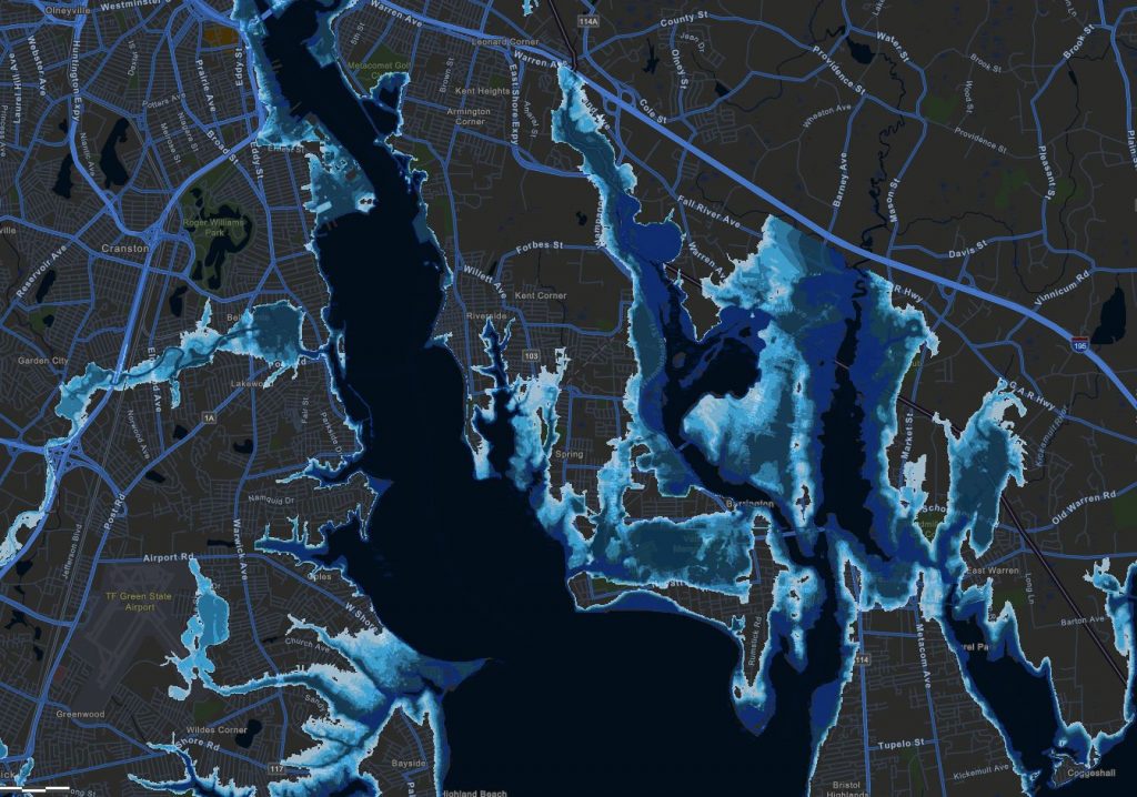
STORMTOOLS is Rhode Island’s go-to web-based mapping platform for visualizing future flood impacts—both coastal and riverine—under different sea level rise and storm scenarios. Developed by the University of Rhode Island in partnership with the Coastal Resources Management Council (CRMC), the tool has become integral to municipal planning, state permitting, and even property owner decisions.
Sea Grant played a key role in this adoption. Early on, staff trained municipal officials in some of the state’s most flood-prone communities on how to apply STORMTOOLS in real-world planning.
For Rhode Island, STORMTOOLS offers the most detailed storm surge maps. >> Providence Journal
These trainings have shaped major projects, such as the redesign of Narragansett’s wastewater treatment facility, which incorporated long-term flood projections for resilience. CRMC also integrated STORMTOOLS into the Rhode Island Beach Special Area Management Plan (Beach SAMP), ensuring its use in coastal policy and permitting.
Today, STORMTOOLS is used in all 21 of Rhode Island’s coastal communities, with at least ten municipalities incorporating its data into their hazard mitigation and comprehensive plans. The Coastal Resources Management Council now requires shoreline development applicants to use the Coastal Hazards app—part of the STORMTOOLS suite—to assess flood risks for proposed projects. STORMTOOLS is also available through MyCoast, enabling the public to overlay flood projections on familiar local maps.
“I’ve been actively using these tools in support of our critical emergency management functions…to mitigate, prepare for, and respond to storm and flood impacts in Providence,” said Clara Decerbo, Director of Providence Emergency Management Agency and President of Rhode Island Emergency Managers, during a state testimony this spring. “I’ve used STORMTOOLS for over seven years, and it’s a critical tool for all of our coastal communities to view their flood risk under current storm scenarios as well as future conditions with the expansion of the system to include inland flooding of all 39 cities and towns.”
By combining science-based projections with user-friendly maps, STORMTOOLS has helped communities and decision-makers across Rhode Island better prepare for the floods of today and tomorrow.
MyCoast: Turning Residents into Data Collectors
Sea Grant also leads Rhode Island’s use of MyCoast, a community science platform that collects crowd-sourced photos of flooding and erosion, and has been leading the regional effort to actively use MyCoast for outreach and data collection, positioning the state as a regional leader.
Since its launch in 2014, the shoreline monitoring program has drawn growing community participation, generating thousands of photos documenting flooding, erosion, and storm impacts. Over the past decade, more than 1,500 Rhode Islanders have contributed images, including over 600 photos of king tides submitted just last year.
“King tides are a good visual estimation of what our coast will look like with sea level rise in the future,” says Casey Tremper, coastal resilience specialist with Rhode Island Sea Grant.
The addition of CoastSnap stations at Barrington, East Matunuck, and Misquamicut has expanded the program’s utility. In one case, CoastSnap data helped the Town of Barrington save $100,000 by revising shoreline protection plans for Latham Park.
MyCoast data has also been used to validate flood models, develop StoryMaps for public education, and inform emergency messaging during high tide and rainfall flooding events.
“We are using STORMTOOLS every day along with photographs from MyCoast to ground truth what’s happening in the field to make it real for decision-makers,” said Teresa Crean, Director of Resilience and Sustainability for the City of Newport, during the state’s Senate Finance hearing in May.
Sea Grant for Coastal Resilience
As part of its mission to strengthen Rhode Island’s coastal communities, Sea Grant connects researchers with local governments, resource managers, and stakeholders. By translating complex science into formats decision-makers can use, Sea Grant ensures that these tools don’t just sit on a server—they shape real-world action.
With new state funding, Sea Grant and its partners will continue training municipalities, refining outreach, and keeping Rhode Island at the forefront of coastal safety, early warning systems, and resilience.
Thank you to our partners at the University of Rhode Island, RI Coastal Resources Management Council, Save the Bay, Woonasquatucket River Watershed Council, Coastal Resource Center, RI Dept. of Transportation, RI Dept. of Environmental Management, and Coastal Resilience Center of Excellence att UNC Chapel Hill .
– Meredith Haas, RISG Science Communications & Digital Strategy Lead


