Floods and storms are threats to all coastal communities, and port communities are even more vulnerable. The materials ports house can be particularly hazardous if damaged or disbursed by hurricanes and storm surge.
That’s one of the reasons the Community-Driven Coastal Climate Research and Solutions (3CRS) Hub project is focusing on the resilience of port communities both in Rhode Island (Providence and Galilee) and in Maine (Rockland and Bath).

Construction materials at the Port of Providence await delivery.
Photo by Monica Allard Cox
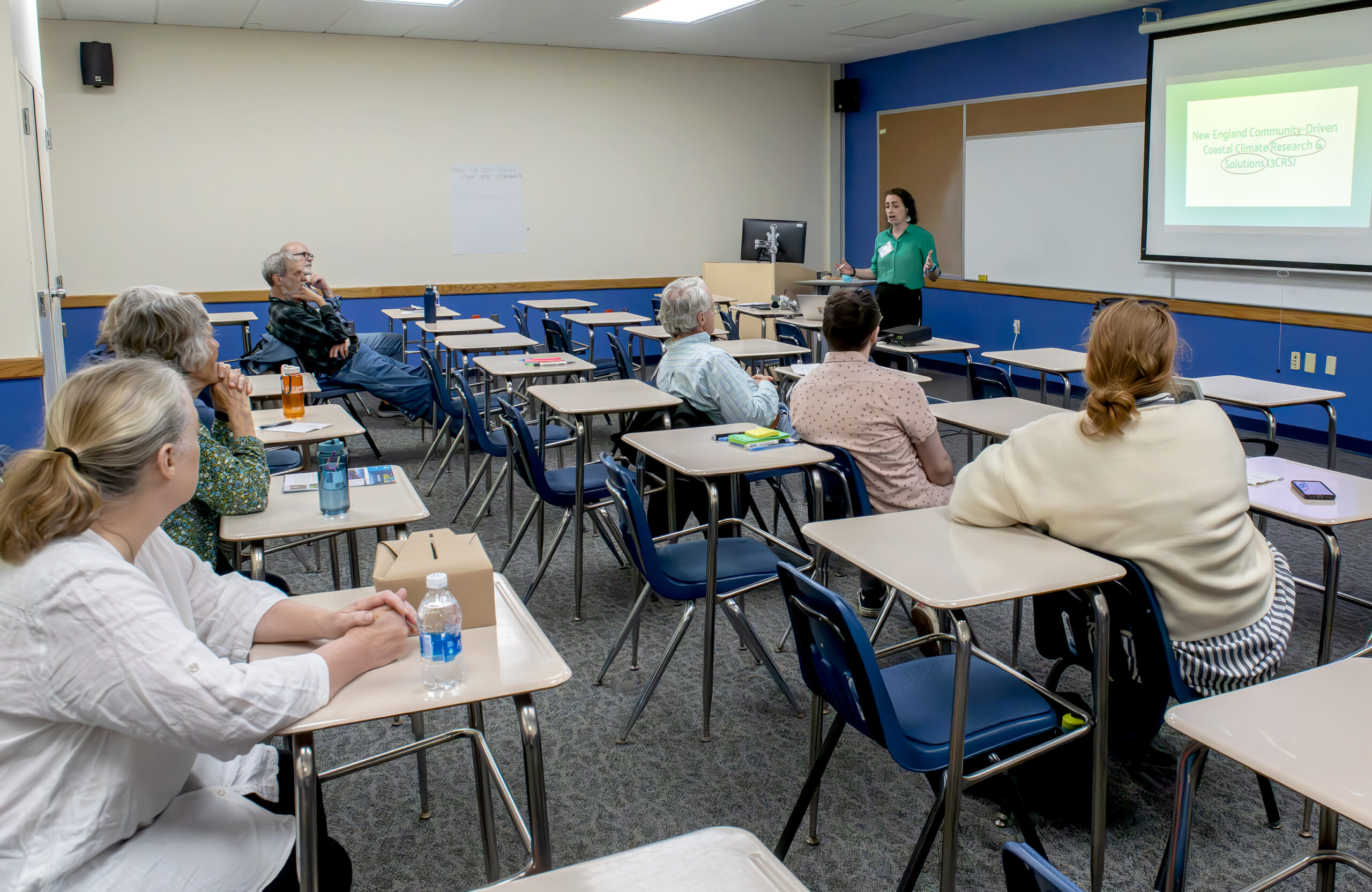
Casey Tremper, coastal specialist with the University of Rhode Island Coastal Resources Center and Rhode Island Sea Grant, discussed the tools the 3CRS project has pulled together to improve resilience at a workshop at the recent Providence Port Day hosted by the nonprofit The Providence Eye.
Researchers have installed inexpensive solar-powered water-level sensors in port communities in Providence and Narragansett to better understand localized flooding and sea level rise.
Tremper explained that the sensors, developed by Brown University researcher Sol Cooperdock, can be installed on poles at a height of 5-10 meters above the surface they are monitoring, whether a stream, a street, or a parking lot that is prone to flooding. She said the sensors use ultrasonic waves that can detect a water level change within 3 centimeters. While the sensors have been installed primarily in the two Rhode Island project areas in Providence and Galilee, Tremper said:
“The goal is eventually to have a whole Brown network all across Rhode Island. So if you want sensors put up, let us know.”
“In Providence, we’ve got a few,” she added. “We’ve got them over water, and there are a few over land that have been put at locations that we were told specifically have road flooding.”

Casey Tremper, coastal specialist for Rhode Island Sea Grant and the URI Coastal Resources Center, presents on tools communities can use to become more resilient to flooding, including water level sensors and mapping programs.
Photo by Monica Allard Cox
That input came from the Providence Emergency Management Agency and the Woonasquatucket River Watershed Council. Further locations will also be determined based on a focus group with Providence residents that the 3CRS project held in the city in December.
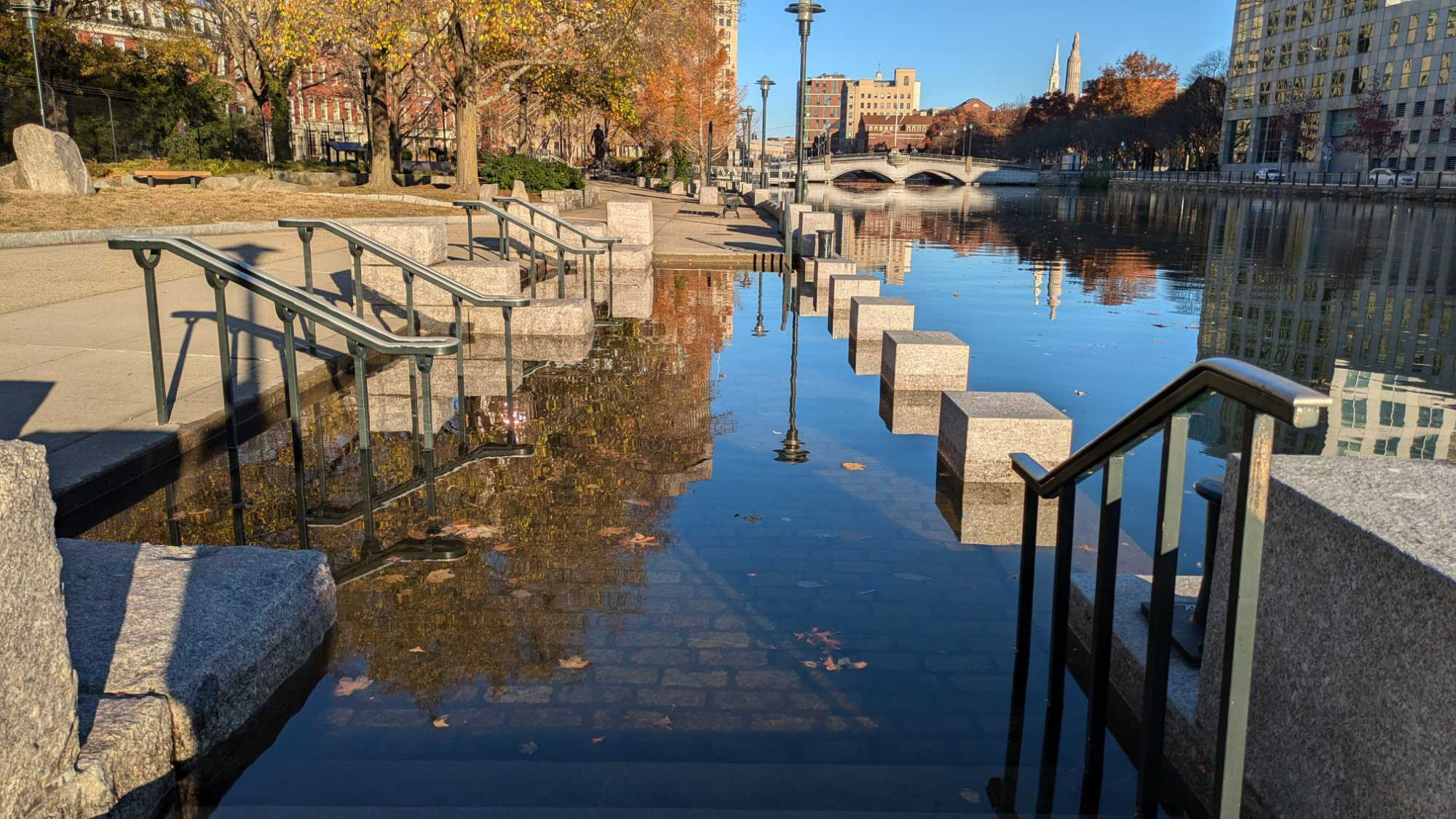
Tremper also discussed MyCoast RI, an online tool that allows volunteers to upload photos of flooding from extreme tides and storms, a process that locates those photos on a map and connects them to weather and tide data, producing a report that can be accessed by anyone for use in educating others about flooding, serving as support for grant proposals, or identifying areas for interventions such as better stormwater management to reduce erosion.
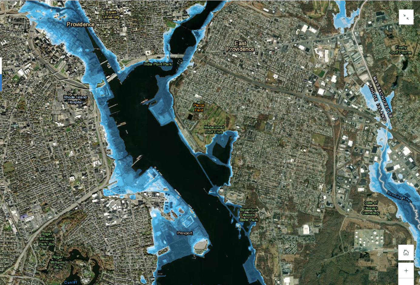
Tremper described the Rhode Island flood mapping tools StormTools and RI-CHAMP, which offer detailed visualizations of locations and infrastructure that will be affected, and how much, by given potential storm and sea level rise scenarios.

A view of a StormTools map showing the inundation of Providence under a sea level rise and storm surge scenario.
Project leaders intend to have the information from the flood sensors and MyCoast improve the modeling tools StormTools and RI-CHAMP.
StormTools illustrates and displays storm inundation, with and without sea level rise, for different types of storms that could occur along Rhode Island’s coastline, while the RI-CHAMP project offers a real-time hazard and impact prediction system for hurricanes and nor’easters in Southern New England. StormTools may be accessed by the public, while RI-CHAMP is accessible to registered users, such as municipal planners, though the RI CHAMP website, which explains the tool, is publicly available.
Tremper invited workshop attendees to participate as MyCoast volunteers or to share with her places they were aware of that should be monitored by volunteers due to their vulnerability.
Tremper further said that the 3CRS project team is looking to support port communities in becoming more resilient. One way, she said, was through helping them identify grant opportunities and assisting them with using the data from these various tools to write grants that will help address the problems identified by the tools—for example, seeking funding to fix issues that lead to repeated flooding of a particular road.

MyCoast images like this one showing king tide flooding in downtown Providence can be used to validate models like StormTools.
Photo by Amanda I.
For more information, visit the 3CRS website or contact Casey Tremper at casey_tremper@uri.edu.
– By Monica Allard-Cox
