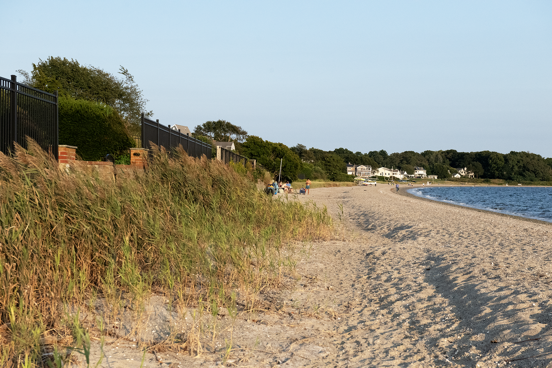
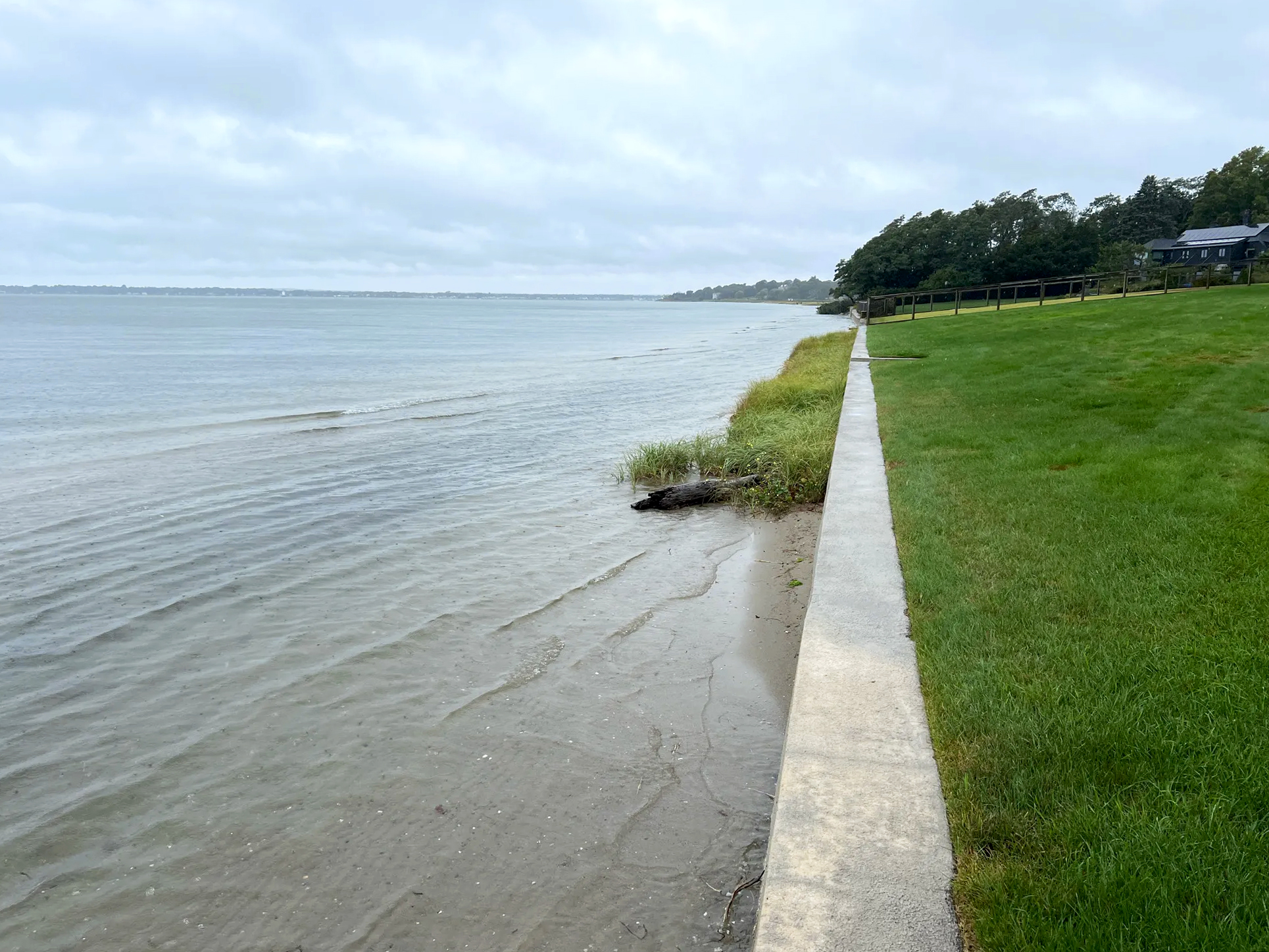
This depression in the sand at Barrington Beach is caused by exceptionally high tides that overtop the beach and by reflection of waves hitting seawalls. To see what the beach looks like where there are no seawalls, scroll to photo at the bottom of this page.
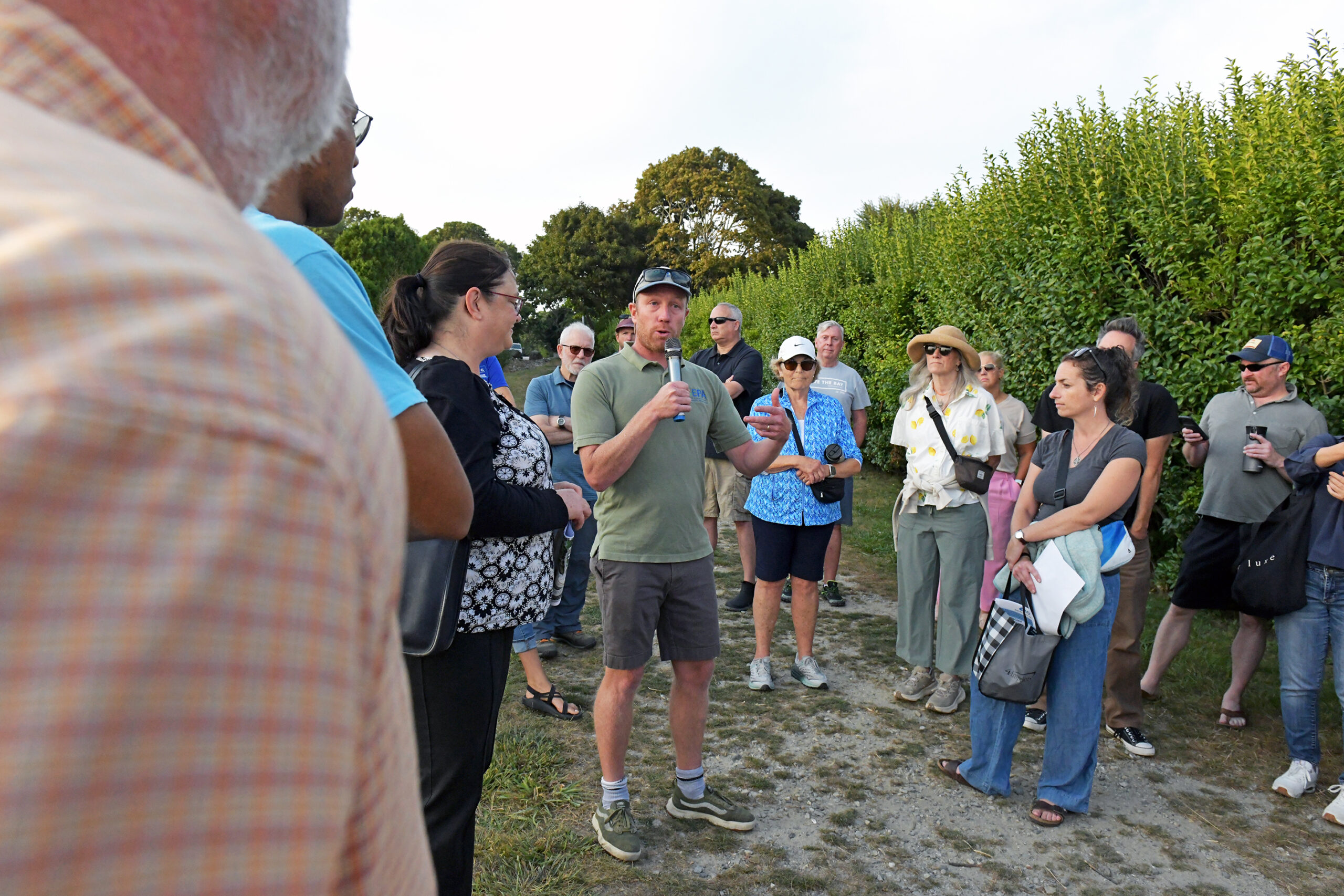
The group of over 40 people gathered on a narrow walkway at Barrington Town Beach drew quizzical looks from passersby. Perhaps it was the large posterboard showing aerial views of Barrington shoreline access points, or perhaps it was the sight of the town’s planning director, dressed for a school building committee meeting, talking into a karaoke microphone about green infrastructure projects along the coast.
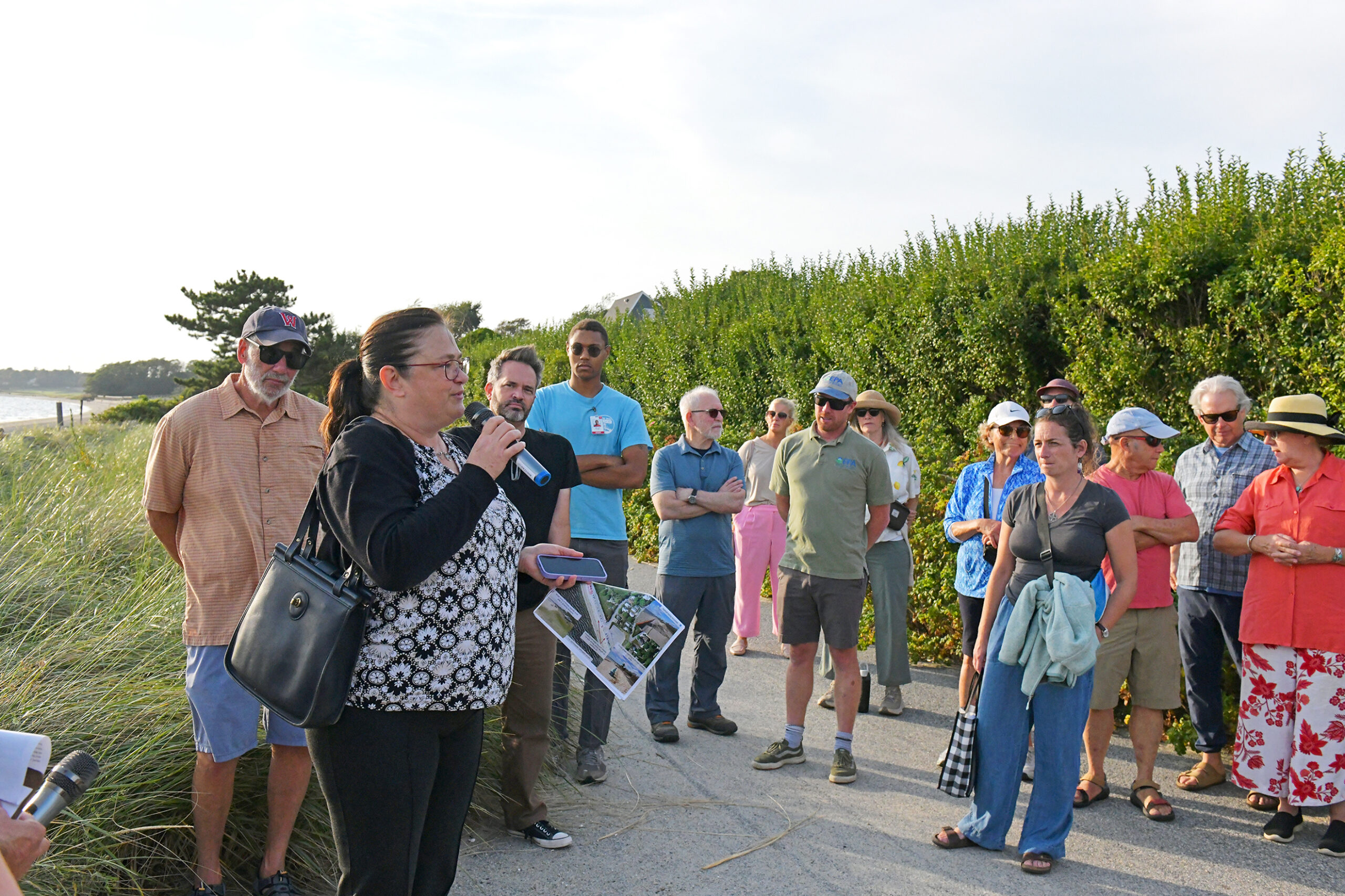
Teresa Crean, then-Barrington town planner, speaks to beach walk participants about the town’s green infrastructure and comprehensive planning efforts.
The beach was an unlikely spot for an educational seminar, but as the convergence of many shoreline issues—stormwater and water quality, sea level rise and shoreline access—the setting was appropriate.
Hosted by the Rhode Island Coastal Resources Management Council (CRMC), Rhode Island Sea Grant, and the University of Rhode Island Coastal Institute, the walking tour also featured discussions of a research project that brought together experts in shoreline processes, resource economics, and the law.
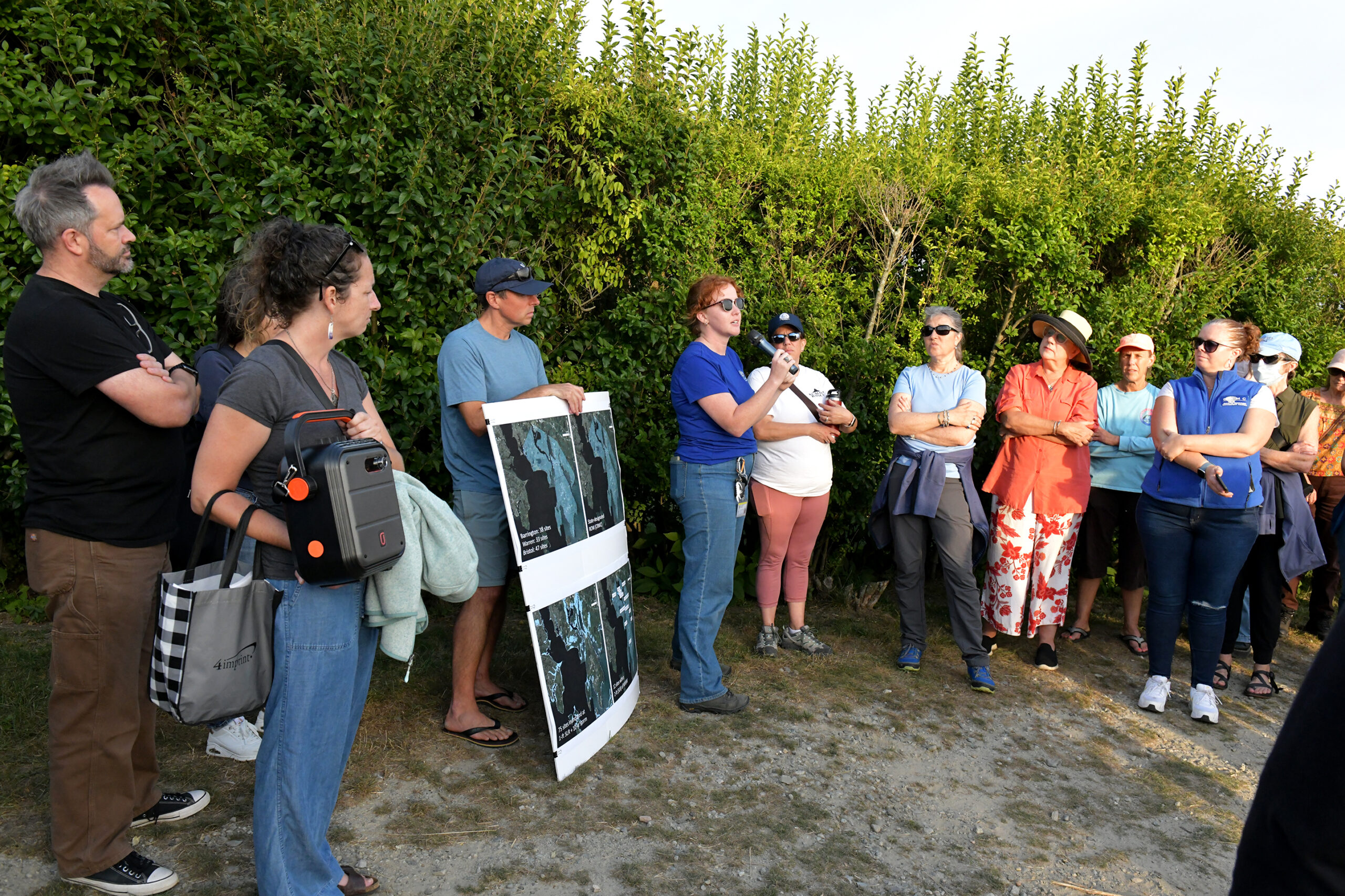
One of the first stops on the tour of the beach was at a storm drainage area lined with rocks. Teresa Crean, then-Barrington director of planning, building, and resilience, told the crowd that the town received funding for a new design for the site that “would be more aesthetically pleasing” with plantings, and was working with Wenley Ferguson, restoration director for Save The Bay, to create green infrastructure that would be “a little more stepped down, and have some basins for infiltration, so it’s not water just shooting down the the rocks in one shot as a channel.”
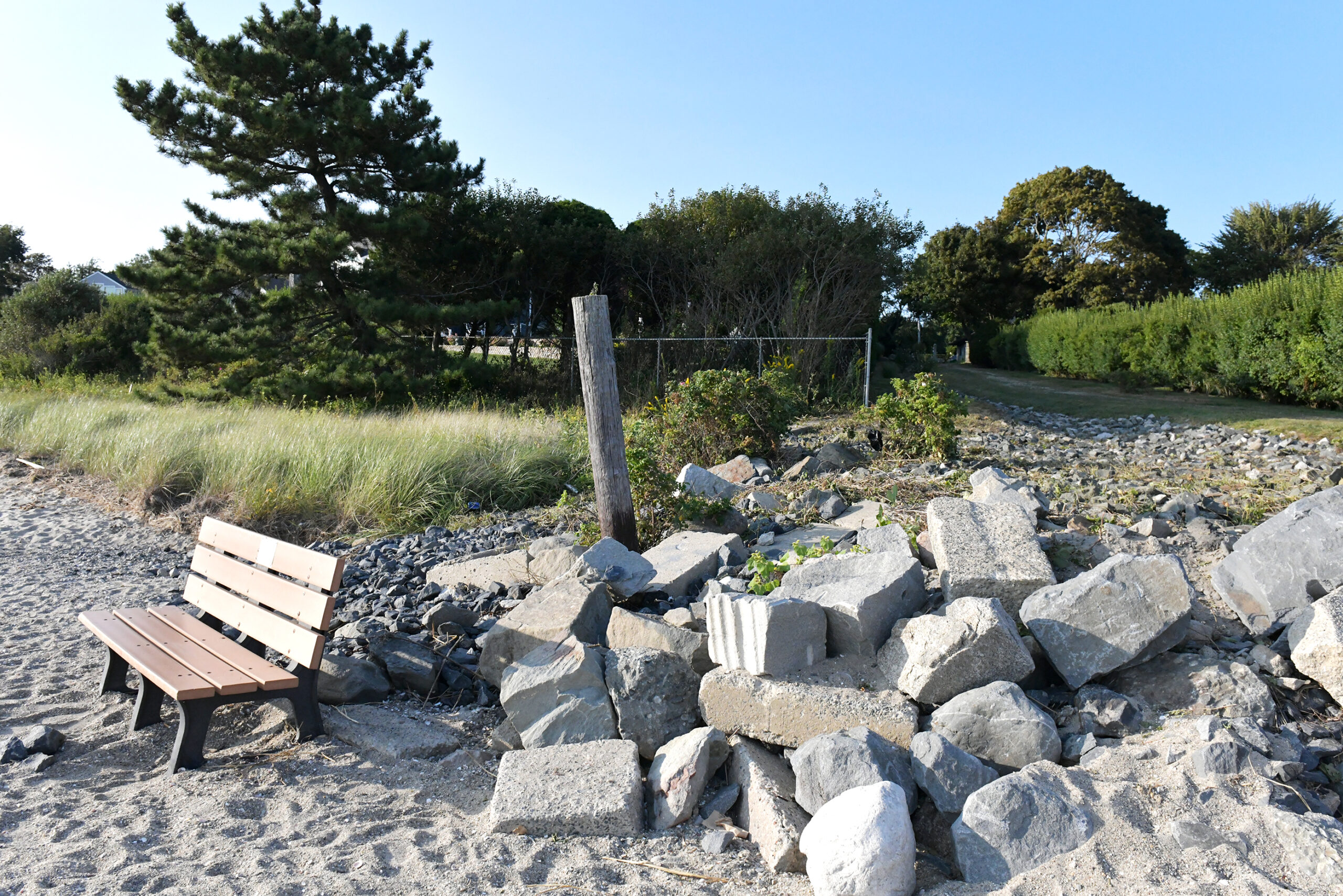
This rocky storm drainage area is targeted for green infrastructure to improve infiltration.
This infiltration capability is meant to improve water quality by removing bacteria from the runoff before it can reach the beach.
This project is one of several such efforts Barrington is working on—including end-of-road retrofits, removing pavement to create more natural areas at the water’s edge—for which the town had secured approximately $700,000 in funding, Crean said. She encouraged Barrington residents to share their ideas for what they would like their town to look like in the future through the comprehensive planning process known as Barrington 2050.
Next spoke Nathan Vinhateiro, science director for the Coastal Institute, who is leading a Rhode Island Sea Grant-funded project called “SEA-C,” or Sustained and Equitable Access to Rhode Island’s Coast in a Changing Climate. The research team has compiled a GIS inventory of 118 public access sites in Bristol County, with 38 of those being in Barrington. (Notably, only two of those Barrington sites are official CRMC rights-of-way, a designation that offers them additional, permanent protection as ROWs.)
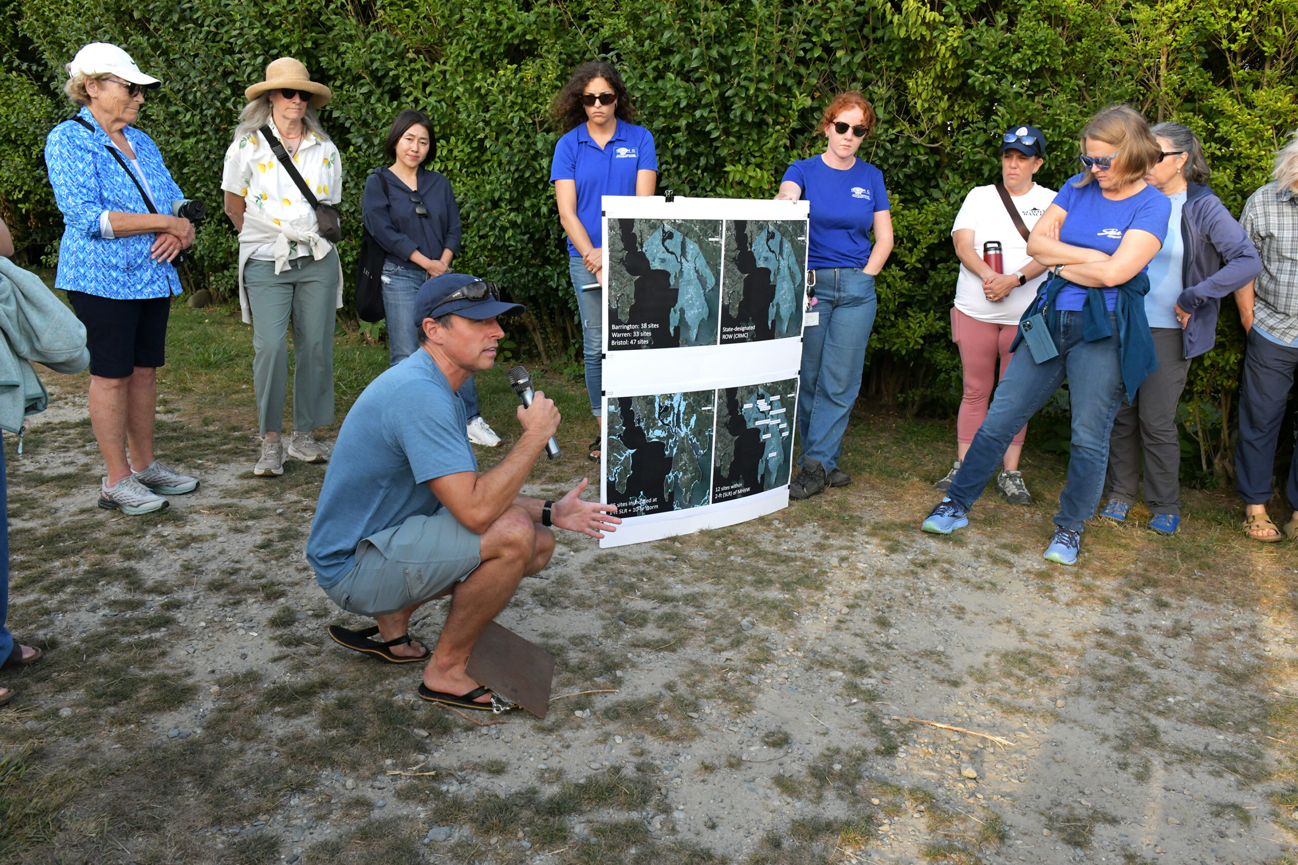
Nathan Vinhateiro, URI Coastal Institute science director, shows aerial views of where Barrington shoreline access sites will be impacted by sea level rise.
Vinhateiro calculated that with a foot of sea level rise, given their low elevations, nearly two thirds of those sites “are in danger of being inundated under very moderate storm conditions.”
With two feet of sea level rise, expected in the next few decades, 12 of those sites “are potentially underwater … Some portion of shoreline access is going to be severely restricted,” he said, and added that over half the sites “are within a couple hundred feet of some sort of hardened coastal structure … we’re going to be facing a situation where the shoreline is just going to be getting squeezed out.”
“Beaches naturally want to respond by moving landward in response to sea level rise,” Vinhateiro added. “But if there’s a hard structure in its way, that’s where we have this phenomenon that people refer to as ‘coastal squeeze,’ where the sea level rises, the beach is not able to migrate, and so the consequence of that is restricted lateral access.”
Vinhateiro said that sea level has risen a foot in Rhode Island in the last 100 years, during which time the shoreline at Barrington Beach has retreated 20-40 feet, and in some places, even more than that. And sea level rise is accelerating. “So the forecast now is that we’re going to see another foot of sea level rise in the next 10 to 15 years, and close to two feet by 2050.”
When Barrington Beach finds itself frequently, or even entirely, underwater, shoreline access will be lost. But who—besides nearby residents—will be affected, and how much?
The Environmental Protection Agency (EPA) is interested in answering that question to help it direct its grant resources and policymaking most effectively.
Nate Merrill of the EPA described using a variety of data sources to understand visitation to Barrington Beach and other shoreline access locations.
Nate Merrill, an environmental economist with the EPA Office of Research and Development at the URI Bay Campus, is on the research team. He said he is using a variety of traditional methods, such as car counts and surveys, and new methods, such as cell phone data and aerial imagery, to understand the levels of visitation to beaches and how far people are coming to access them. This use data is being overlaid on the vulnerability assessment to create a risk metric, Merrill said. “Essentially, where are sites that are heavily used now that are also vulnerable to sea level rise that might be worth addressing to have more impact for more people?”
In addition to understanding which access sites are more heavily used, the cell phone data is showing that a moderate percentage of visitors are coming from census districts with a high poverty rate or high racial diversity in Rhode Island and neighboring states, said Emi Uchida, professor and chair of URI’s Department of Environmental and Natural Resource Economics, meaning that the beach benefits all sorts of populations.
“And then kind of the next step is to understand what are some potential barriers to access these coastal sites, and ask whether the impact of climate change might impact different populations differently,” she added.
Jesse Reiblich, URI marine affairs professor and lawyer, talked about his part of the project, which involves finding out what legal barriers there are to access and how those will change under sea level rise. He described some of the potential policy considerations, such as giving a coastal property owner whose property is threatened by sea level rise, a “life estate,” in which an owner is allowed to live in a property until they die, at which time the property would pass to a local or state government, which could use the property to provide public shoreline access.
In addition to the research, CRMC staff discussed some of the laws and regulations pertaining to coastal property and shoreline access. In light of the many properties with seawalls along Barrington Beach, CRMC Coastal Geologist Emily Hall mentioned that if a private seawall is damaged more than 50%, it may not be rebuilt. (In a situation where a structure provides a compelling public purpose, however,a property owner could apply for a special exception through the RI Coastal Resources Management Program.) Leah Feldman, CRMC coastal policy analyst, discussed the 2023 lateral access law that defines public access to the shoreline as being permitted up to 10 feet above the wrack, or debris, line on the beach. While that law is being legally challenged as a taking of private property, a final decision has not yet been made, and CRMC continues to enforce the law as written.
Barrington Beach at Clarke Road during a king tide, September 21, 2024, just four days after the walk. MyCoast photo by Dave Rizzolo
The walk took place on the cusp of a king tide, an especially high tide caused when a spring tide (when the sun, moon, and earth align during a new and full moon, increasing tide ranges) takes place when the moon is closest to Earth during the 28-day elliptical orbit (known as a perigee). Casey Tremper, an extension specialist with the URI Coastal Resources Center and Rhode Island Sea Grant, invited attendees to participate in MyCoast, an effort to capture coastal flooding from king tides and storms with photographs uploaded to the MyCoast website. MyCoast “helps to inform modeling that a lot of the URI scientists are doing. It also helps to inform these types of plans that Teresa (Crean) is talking about,” she said.
More information
Emily Hall, coastal geologist for CRMC, talks about CRMC’s permitting for coastal resilience measures on properties within 200 feet of a coastal feature.
CRMC’s website has lots more information about public access, including recordings of past webinars that were a part of this educational series. It also includes a GIS map of all CRMC-designated rights-of-way to the shore.
Rhode Island Sea Grant hosts shoreline-ri.com, a website of select shoreline access sites, including CRMC and municipal ROWs, beaches, parks, fishing areas, boat ramps, and more. The Sea Grant website also includes briefs on previous shoreline access walks, including one in Bristol in 2024 and Charlestown in 2023.
Barrington’s Comprehensive Planning website can be found at https://barrington.ri.gov/457/Barrington-2050-Comprehensive-Plan
The Coastal Institute’s website includes information about its public shoreline access efforts.
Save The Bay has worked on many green infrastructure projects, including one at Barrington Town Beach, where pavement was removed and beach grasses planted to improve infiltration and reduce runoff.
MyCoast: Rhode Island is a portal to collect and analyze photos that capture the impact of flood hazards. Photos, linked to data about weather and tides, create reports that help stakeholders like government agencies, business owners, and residents to understand shoreline change and make informed decisions.
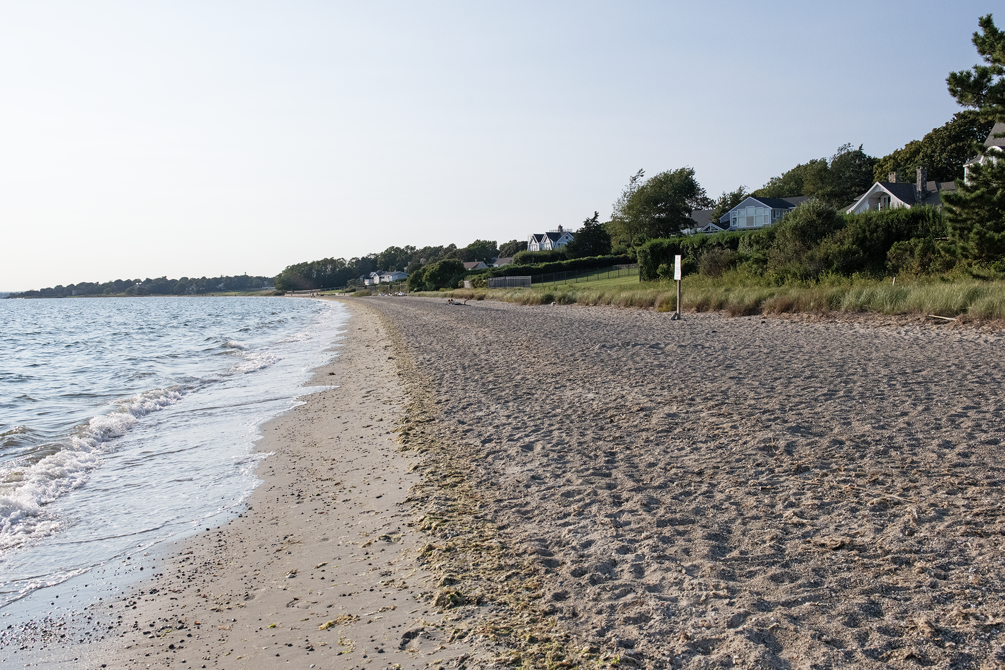
A view of Barrington Beach shows the shape of the beach where there are no seawalls to reflect wave energy.